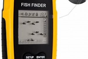
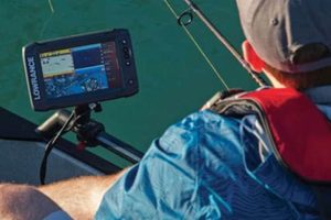
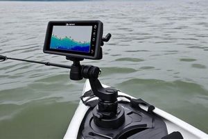
A compact, waterproof electronic device designed for anglers, this technology combines the navigational capabilities of global positioning systems with sonar technology to locate fish and map underwater terrain. Typically mounted on a kayak, these units display real-time location, water depth, temperature, and often, detailed images of the underwater environment, including fish and bottom structure. Some models offer advanced features such as route planning, waypoint marking, and data logging.
These integrated systems offer significant advantages for kayak anglers. Knowing precise location enhances safety and allows for efficient navigation, particularly in unfamiliar waters or challenging conditions. The sonar component provides crucial information about water depth, bottom structure, and fish presence, maximizing fishing success. This technology has evolved significantly, moving from basic depth finders to sophisticated, portable devices capable of providing highly detailed underwater mapping and GPS navigation. This evolution has broadened access to previously inaccessible fishing spots and improved angling techniques.
The following sections will explore specific types of these devices, key features to consider when selecting a unit, and practical tips for installation and usage on a kayak.
Tips for Utilizing Kayak GPS Fish Finder Technology
Maximizing the effectiveness of a kayak-mounted GPS and fish finder requires understanding key operational aspects and employing best practices. The following tips offer guidance for optimal usage and improved angling success.
Tip 1: Transducer Placement is Crucial: Correct transducer placement is paramount for accurate readings. Mounting the transducer too low can result in turbulence interference. Too high, and bottom readings may be inaccurate. Follow manufacturer guidelines for optimal placement specific to the kayak and transducer model.
Tip 2: Understand Sonar Settings: Familiarization with sonar settings, including sensitivity, frequency, and cone angle, allows users to customize the device for specific water conditions and target species. Experimentation and practice are essential for interpreting sonar readings effectively.
Tip 3: Utilize Waypoint and Route Features: Marking productive fishing spots as waypoints and creating navigational routes enhances efficiency and allows anglers to return to successful locations. These features are invaluable for navigating in challenging environments or during low-visibility conditions.
Tip 4: Regularly Update GPS Data: Ensure the device’s GPS software and maps are up-to-date for accurate positioning and navigation. Consult the manufacturer’s instructions for updating procedures.
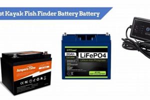
Tip 5: Power Management is Key: Monitor battery consumption to avoid unexpected power loss during outings. Carry spare batteries or consider a dedicated power source for extended trips.
Tip 6: Learn to Interpret Bottom Contour: Understanding how bottom contour affects fish behavior is crucial. Changes in depth, structure, and vegetation often indicate prime fishing locations. Practice correlating sonar readings with observed underwater features.
Tip 7: Protect the Device: These units are designed for outdoor use, but proper care extends their lifespan. Ensure the device is securely mounted and protected from impacts and excessive exposure to the elements.
By following these tips, anglers can significantly improve their understanding and utilization of these integrated systems, leading to enhanced navigation, increased fishing success, and a safer, more enjoyable on-the-water experience.
This information provides a practical foundation for leveraging the advantages of this technology. The concluding section will summarize key benefits and offer final recommendations.
Navigation forms a cornerstone of effective kayak fishing, significantly amplified by integration with GPS technology. Precise positioning information, coupled with route planning and waypoint marking capabilities, allows anglers to navigate efficiently to desired fishing locations, explore unfamiliar waters, and return safely. This eliminates reliance on traditional, less precise navigational methods, particularly advantageous in challenging conditions such as fog or darkness. Consider a scenario where an angler identifies a promising fishing spot several miles offshore. GPS navigation facilitates precise navigation to the target area, even in conditions of reduced visibility. Furthermore, waypoint marking allows for easy return to the location on subsequent trips.
The ability to track location and movement contributes to both efficiency and safety. Anglers can optimize time on the water by navigating directly to productive areas, rather than searching blindly. Furthermore, GPS navigation provides a critical safety net in emergency situations, enabling rapid communication of location to rescue services. Imagine a kayak angler experiencing equipment failure in a remote area. The integrated GPS allows for immediate determination of location and transmission of coordinates to emergency responders, facilitating a swift and effective rescue.
In essence, the navigational component of a kayak GPS fish finder transforms the angling experience. It provides a level of precision and control previously unavailable, enhancing efficiency, expanding exploration opportunities, and improving overall safety. Understanding and utilizing these navigational features are essential for maximizing the potential of this technology and ensuring a safe and productive fishing experience.
2. Fish Location
Fish location functionality represents a core element of kayak GPS fish finder technology. Sonar technology, integral to these devices, transmits sound waves into the water. These waves reflect off objects, including fish, and return to the transducer. The device then interprets these returning signals, displaying information about depth, bottom structure, and fish presence on the screen. This real-time information empowers anglers to identify promising fishing areas quickly and efficiently, significantly increasing the likelihood of success. Consider a scenario where an angler is searching for schooling fish near a drop-off. The fish finder’s sonar can pinpoint the location of the fish relative to the kayak’s position and the underwater terrain, allowing the angler to cast directly to the target zone.
The effectiveness of fish location hinges on understanding sonar interpretation. Distinguishing fish from other underwater objects, such as vegetation or debris, requires practice and experience. Modern fish finders offer advanced features, such as down-imaging and side-imaging sonar, which provide detailed visual representations of the underwater environment, further enhancing fish identification capabilities. For example, down-imaging sonar can clearly depict individual fish within a school, even in murky water, providing valuable insight into fish size and distribution. This precise information allows anglers to tailor their techniques and lure selection for optimal results.
Precise fish location capability, coupled with accurate GPS positioning, revolutionizes kayak fishing. Anglers can focus efforts on areas with confirmed fish presence, maximizing fishing time and increasing catch rates. While mastering sonar interpretation requires a learning curve, the benefits of accurate fish location are undeniable. This capability transforms the search for fish from a chance encounter into a strategic pursuit, significantly enhancing the overall angling experience and ultimately leading to greater success on the water.
3. Bathymetric Mapping
Bathymetric mapping, the underwater equivalent of topographic mapping, constitutes a crucial component of advanced kayak GPS fish finder functionality. These devices utilize sonar data not only to locate fish but also to create detailed maps of the underwater terrain. Understanding bottom contours, depth variations, and substrate composition provides crucial insights into fish behavior and habitat preferences. Fish often congregate around specific underwater features, such as drop-offs, humps, and submerged vegetation. Bathymetric mapping allows anglers to identify these key areas, transforming the search for fish from a random process into a strategic endeavor. Consider a river system: bathymetric maps can reveal deep channels, sandbars, and rocky areas, providing clues to where different fish species might reside. This information enables anglers to target specific areas based on the species they seek, significantly increasing the likelihood of success.
The ability to create and save bathymetric maps offers significant long-term advantages. Anglers can build a personalized database of productive fishing spots, including detailed information about bottom structure and depth. This information becomes increasingly valuable over time, allowing for efficient navigation and targeted fishing in familiar waters. Imagine a reservoir with numerous submerged points and coves. A kayak GPS fish finder with bathymetric mapping capability allows an angler to create a detailed map of these features, marking productive locations and noting depth variations. This personalized map becomes an invaluable tool for future fishing trips, enabling the angler to quickly navigate to previously successful areas and adapt fishing strategies based on the specific underwater terrain.
Bathymetric mapping capabilities transform kayak GPS fish finders from simple fish-locating devices into sophisticated tools for understanding and interacting with the underwater environment. This detailed underwater mapping provides crucial insights into fish habitat and behavior, significantly enhancing angling efficiency and success. While interpretation of bathymetric data requires some learning and experience, the ability to visualize the underwater landscape adds a new dimension to kayak fishing, ultimately leading to a more informed, strategic, and successful angling experience.
4. Safety Enhancement
Safety enhancement represents a critical, often overlooked, benefit of kayak GPS fish finder technology. While the primary focus often centers on fish location and navigation, the safety implications of having precise location information, particularly in remote or challenging environments, are significant. Consider a kayak angler venturing into unfamiliar coastal waters. Fog rolls in, reducing visibility significantly. The integrated GPS functionality allows the angler to pinpoint their exact location and navigate safely back to shore, avoiding potential disorientation and hazardous situations. This capability provides a crucial safety net, mitigating risks associated with unpredictable weather conditions and navigational challenges.
Beyond navigational safety, these devices can also play a vital role in emergency situations. If a kayak capsizes or an angler experiences a medical emergency, the GPS functionality allows for immediate determination of location. This information can then be communicated to emergency responders, facilitating a swift and effective rescue. Imagine a solo kayaker suffering an injury miles offshore. The ability to transmit precise GPS coordinates to rescue services can significantly reduce response time and potentially save lives. This aspect of safety enhancement transforms the kayak GPS fish finder from a convenience tool into a potentially life-saving piece of equipment.
While features like fish location and bathymetric mapping contribute to a more productive fishing experience, the safety enhancement offered by integrated GPS technology provides peace of mind and a critical layer of protection. Understanding and utilizing this functionality is essential for responsible kayak angling, particularly in remote or challenging environments. Prioritizing safety alongside other features ensures a more enjoyable and secure experience on the water, allowing anglers to focus on the sport while mitigating potential risks.
5. Device Portability
Device portability is a defining characteristic of contemporary kayak GPS fish finders, directly influencing their practicality and usability. Kayaks, by nature, necessitate compact and easily transportable equipment. Modern units address this requirement through lightweight design, integrated battery options, and versatile mounting systems. This portability facilitates easy installation and removal, allowing anglers to transfer the unit between kayaks or store it securely when not in use. Consider the scenario of an angler transporting their kayak to a remote lake. A portable fish finder can be easily packed and then mounted upon arrival, minimizing setup time and maximizing fishing time.
The portability of these devices extends beyond simple transport. Compact designs and versatile mounting options allow for flexible positioning on the kayak, ensuring optimal visibility and accessibility while maintaining a streamlined profile. This adaptability is crucial in the confined space of a kayak cockpit. For example, adjustable mounts permit anglers to position the display for clear viewing while paddling, navigating, or fishing, enhancing both safety and efficiency. Furthermore, portable units often incorporate quick-release mechanisms, enabling rapid removal of the device for storage or transport, protecting it from theft or damage.
Portability directly impacts the overall utility of kayak GPS fish finders. The ability to easily transport, install, and adjust these devices enhances their practicality in the context of kayak fishing. This characteristic allows anglers to leverage the benefits of advanced technology without compromising the inherent maneuverability and portability of their kayaks. The convergence of sophisticated functionality within a compact, portable package underscores the evolution of these devices and their increasing importance in modern kayak angling.
6. User Interface
The user interface (UI) of a kayak GPS fish finder significantly impacts its practical usability and effectiveness on the water. A well-designed UI simplifies complex functionalities, presenting information clearly and intuitively. This allows anglers to focus on fishing rather than deciphering complicated menus or controls. Clear visual displays, logical menu structures, and readily accessible buttons enhance operational efficiency, particularly in dynamic fishing environments where quick adjustments are often necessary. Consider a scenario where an angler needs to adjust sonar sensitivity due to changing water conditions. A user-friendly interface allows for quick and intuitive adjustments, minimizing disruption to the fishing experience.
The importance of UI design extends beyond basic functionality. Effective interfaces incorporate features tailored to the specific demands of kayak fishing. Sunlight-readable displays ensure visibility in bright conditions, while waterproof designs protect against splashes and inclement weather. Intuitive controls, operable even with wet hands or gloves, further enhance usability in challenging on-the-water conditions. For example, a touchscreen interface might offer advantages in calm conditions, but physical buttons often prove more reliable in rough seas or when operating the device with wet hands. The choice of UI design must consider the practical realities of the kayak fishing environment.
A well-designed user interface represents a critical element of a successful kayak GPS fish finder. It bridges the gap between complex technology and practical application, empowering anglers to effectively utilize the device’s capabilities. Factors such as display clarity, menu structure, button accessibility, and environmental considerations all contribute to UI effectiveness. Prioritizing user-centered design principles results in a more intuitive and efficient user experience, ultimately enhancing both fishing success and overall enjoyment on the water.
7. Durability/Waterproof
Durability and waterproof design are paramount considerations for kayak GPS fish finders given the inherently demanding marine environment. These devices are exposed to a range of potentially damaging elements, including water spray, rain, extreme temperatures, and occasional impacts. Robust construction and reliable waterproofing are essential for ensuring consistent functionality and a prolonged lifespan. A device’s ability to withstand these challenges directly impacts its long-term value and reliability in the context of kayak fishing.
- Water Ingress Protection:
A key aspect of durability is the device’s resistance to water ingress. The IPX rating system provides a standardized measure of this resistance, with higher ratings indicating greater protection against water intrusion. Kayak fish finders should possess a minimum IPX7 rating, signifying protection against temporary submersion. A higher rating, such as IPX8, provides additional assurance against prolonged exposure to water. For example, a device rated IPX7 can withstand accidental submersion in shallow water, while an IPX8 rating ensures functionality even after extended periods underwater. This protection is critical for maintaining functionality in the event of capsizing or accidental drops overboard.
- Impact Resistance:
Kayaks often operate in close proximity to rocks, submerged debris, and other potential hazards. Impact resistance is therefore crucial for ensuring the device’s structural integrity. Robust housing materials, reinforced mounting points, and protective screen covers contribute to impact resistance. Consider a scenario where a kayak strikes a submerged log. A fish finder with robust impact resistance is more likely to survive the impact without damage, ensuring continued functionality throughout the fishing trip. This durability translates to long-term reliability and reduced risk of costly repairs or replacements.
- Temperature Tolerance:
Kayak fishing often occurs in diverse climates, ranging from frigid winter conditions to scorching summer heat. A durable fish finder must tolerate these temperature fluctuations without compromising performance. Components designed to operate across a broad temperature range ensure consistent functionality regardless of weather conditions. For example, a fish finder used in both summer and winter should be able to withstand both direct sunlight and freezing temperatures without malfunctioning. This temperature tolerance ensures reliability and consistent performance across diverse fishing environments.
- UV Resistance:
Prolonged exposure to ultraviolet (UV) radiation from sunlight can degrade materials, particularly plastics and displays. UV-resistant materials and coatings protect the device from the damaging effects of sunlight, extending its lifespan and preserving the clarity of the display. Consider a kayak frequently used in sunny conditions. A fish finder with UV resistance will maintain its appearance and functionality over time, whereas a non-UV-resistant unit might experience discoloration, cracking, or diminished display clarity. This resistance contributes to the device’s long-term durability and aesthetic appeal.
These facets of durability and waterproofing are essential for ensuring the reliability and longevity of kayak GPS fish finders. Selecting a device designed to withstand the rigors of the marine environment represents a crucial investment for kayak anglers. A durable and waterproof unit provides consistent performance, minimizes the risk of damage, and ensures a reliable source of navigational and fish-finding information throughout countless fishing adventures.
Frequently Asked Questions
This section addresses common inquiries regarding kayak GPS fish finder technology, providing concise and informative responses.
Question 1: How does sonar technology contribute to fish finding?
Sonar transmits sound waves into the water, which reflect off objects and return to the transducer. The device interprets these echoes, displaying information about depth, bottom structure, and the presence of fish.
Question 2: What is the significance of GPS functionality in a kayak fish finder?
GPS provides precise location information, enabling accurate navigation, route planning, waypoint marking, and enhanced safety, especially in unfamiliar waters or challenging conditions.
Question 3: How does bathymetric mapping enhance angling effectiveness?
Bathymetric mapping creates detailed maps of the underwater terrain, revealing depth variations, bottom contours, and substrate composition. This information helps anglers identify prime fishing locations and understand fish habitat preferences.
Question 4: What are key considerations for choosing a suitable kayak fish finder?
Key considerations include display size and resolution, sonar capabilities (e.g., down-imaging, side-imaging), GPS accuracy, mounting options, battery life, and overall durability/waterproofing.
Question 5: How does transducer placement affect sonar performance?
Correct transducer placement is crucial for accurate sonar readings. Incorrect placement can lead to turbulence interference or inaccurate bottom readings. Consult the manufacturer’s guidelines for optimal placement specific to the kayak and transducer model.
Question 6: What maintenance practices are recommended for a kayak fish finder?
Recommended maintenance practices include regularly cleaning the transducer, ensuring software and map updates, protecting the device from impacts and extreme temperatures, and proper battery care.
Understanding these key aspects of kayak GPS fish finder technology facilitates informed selection and effective utilization.
The subsequent section will offer practical tips for installing and using a kayak fish finder.
Kayak GPS Fish Finder
This exploration of kayak GPS fish finder technology has highlighted its multifaceted role in enhancing the angling experience. From precise navigation and detailed fish location to bathymetric mapping and enhanced safety, these integrated systems offer significant advantages for kayak anglers. Key considerations for selection include display quality, sonar capabilities, GPS accuracy, portability, user interface design, and robust durability/waterproofing. Understanding these aspects empowers informed decisions aligned with individual angling needs and preferences.
Kayak GPS fish finder technology represents a significant advancement in angling, transforming how anglers interact with the underwater environment. As technology continues to evolve, further refinements in functionality and user experience are anticipated. The strategic adoption of these integrated systems empowers anglers to explore new waters, locate fish efficiently, and enhance overall safety, ultimately contributing to a more informed, successful, and enjoyable kayak fishing experience.

