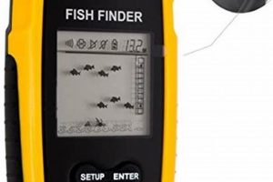
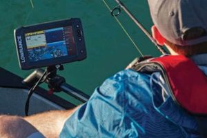
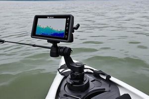
A compact, waterproof navigational system designed for anglers combines the capabilities of a chartplotter, sonar technology, and a global positioning system. These integrated devices typically feature a sunlight-readable display showing real-time location, water depth, bottom structure, and often, fish locations. They can mark waypoints, track routes, and even offer some advanced features like mapping underwater terrain and identifying fish species. A typical unit is mounted on a kayak for easy access and operation during fishing excursions.
These integrated systems offer anglers significant advantages on the water. Knowing precise location and water depth enhances safety and navigation, especially in unfamiliar waters or challenging conditions. The ability to identify fish-holding structures like submerged vegetation, drop-offs, and reefs drastically increases fishing success. Furthermore, marking waypoints for productive fishing spots or navigational hazards allows anglers to return to promising areas or avoid dangerous obstacles. The development of these specialized navigational aids reflects the increasing sophistication and effectiveness of sport fishing technology.
This discussion will delve further into specific features, selection criteria, installation procedures, and effective utilization techniques for these essential tools for the modern kayak angler.
Optimizing the use of electronic navigational aids requires careful consideration of various factors, from initial setup to advanced techniques.
Tip 1: Transducer Placement: Correct transducer placement is crucial for accurate sonar readings. Avoid mounting near sources of turbulence, such as the kayak’s hull or paddle strokes. Optimal locations often include a dedicated mounting arm or inside the hull for certain transducer types.
Tip 2: GPS Accuracy: Ensure the unit has a clear view of the sky for optimal GPS signal reception. Obstructions such as overhanging trees or canyon walls can interfere with satellite communication and reduce accuracy.
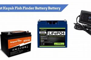
Tip 3: Power Management: Carry spare batteries or a portable power source to extend operational time, especially on longer fishing trips. Monitor battery levels regularly to avoid unexpected power loss.
Tip 4: Chart Updates: Regularly update the charts on the device to reflect changes in navigation buoys, water depths, and other critical information. Using outdated charts can pose navigational hazards.
Tip 5: Waypoint Management: Develop a clear and consistent system for marking waypoints. Use descriptive names and categorize waypoints based on type (e.g., fishing spots, hazards, launch points) for easy retrieval and organization.
Tip 6: Sonar Interpretation: Learn to interpret sonar readings effectively. Understanding how different bottom structures, vegetation, and fish appear on the sonar display significantly increases the chances of locating fish.
Tip 7: Safety First: While these devices are valuable tools, they should never replace sound judgment and navigational awareness. Always be mindful of weather conditions, water traffic, and other potential hazards.
By following these recommendations, anglers can significantly enhance their situational awareness, improve fishing success, and ensure safer navigation on the water.
These practical tips and techniques provide a solid foundation for utilizing modern marine electronics effectively. The next section will explore advanced features and integrations that further enhance the angler’s experience.
Portable navigation is a defining characteristic of modern kayak fishing electronics. The ability to easily transport and deploy these systems distinguishes them from larger, vessel-mounted counterparts. This portability offers significant advantages for kayak anglers, enabling access to diverse fishing locations and streamlined setup on the water.
- Compact Design:
Compact, lightweight units are designed for easy installation and removal from kayaks. This portability facilitates transport between fishing locations, storage at home, and even use in other small watercraft. Modern units often feature integrated mounting systems tailored to kayak configurations.
- Independent Operation:
Battery-powered operation eliminates the need for complex wiring or connections to a kayak’s electrical system. This independence simplifies installation and allows anglers to easily move the unit between kayaks or other vessels. Internal batteries, rechargeable via USB or 12V sources, offer extended operational time.
- Wireless Connectivity:
Integration with smartphones and tablets via Bluetooth or Wi-Fi enhances functionality. Anglers can access advanced features, such as real-time data sharing, chart synchronization, and software updates, wirelessly. This connectivity expands the utility of the portable navigation system beyond basic functions.
- Versatility and Adaptability:
Portable systems cater to diverse fishing environments, from small ponds to vast coastal waters. Their adaptable nature allows for use in various kayaks, canoes, and other small boats. This versatility contributes to the growing popularity of these systems among diverse angling communities.
The convergence of these featurescompact design, independent operation, wireless connectivity, and versatilitymakes portable navigation a cornerstone of modern kayak fishing. These integrated systems offer a streamlined and effective approach to enhancing on-the-water experiences, ultimately improving angling success and overall enjoyment.
2. Underwater Mapping
Underwater mapping capabilities transform kayak fish finder GPS units from simple navigational aids into powerful tools for understanding and interacting with the subaquatic environment. This functionality provides anglers with crucial insights into bottom composition, depth contours, and submerged structures, directly influencing fishing strategies and success.
- Bathymetric Data Acquisition:
Sophisticated sonar technology within these units emits sound pulses and analyzes the returning echoes to determine water depth. This process generates bathymetric data, creating a detailed representation of the underwater terrain. Understanding depth variations is crucial for locating fish-holding structures like drop-offs, channels, and humps.
- Structure Identification:
Beyond simple depth readings, advanced sonar interprets variations in echo returns to identify different bottom types and submerged objects. Distinguishing between rock, sand, vegetation, or debris allows anglers to target specific areas likely to hold their target species. Identifying submerged trees, wrecks, or other structures further enhances the angler’s understanding of the underwater landscape.
- Contour Mapping and Visualization:
Fish finder GPS units process bathymetric data to create visual representations of depth contours on the display. These contour lines provide a clear picture of the underwater terrain, allowing anglers to visualize underwater valleys, ridges, and other features. This visualization aids in identifying potential ambush points or travel corridors used by fish.
- Side-Imaging and Down-Imaging Sonar:
Cutting-edge sonar technologies, such as side-imaging and down-imaging, provide highly detailed images of the underwater environment. Side-imaging sonar scans the area to the sides of the kayak, revealing structures and objects beyond the boat’s path. Down-imaging sonar provides a near-photographic view of the bottom directly beneath the kayak, offering precise details about bottom composition and structure.
By integrating these underwater mapping capabilities, kayak fish finder GPS units provide a comprehensive understanding of the subaquatic environment. This knowledge empowers anglers to make informed decisions about where to fish, what techniques to use, and ultimately, increases the likelihood of a successful fishing trip.
3. Precise Location
Pinpoint positioning is fundamental to the efficacy of a kayak fish finder GPS. Knowing one’s precise location is critical not only for navigation and safety but also for maximizing fishing success. This capability allows anglers to accurately mark productive fishing spots, navigate to specific locations, and understand their position relative to underwater structures and other points of interest.
- Navigation Safety:
Accurate positioning information enables safe navigation, particularly in unfamiliar waters or challenging conditions. Fog, darkness, or complex shorelines present navigational hazards that a reliable GPS system mitigates. Knowing one’s location allows for safe return to launch points, avoidance of obstacles, and efficient route planning.
- Waypoint Marking:
Precise location data allows anglers to mark waypoints at promising fishing locations, navigational hazards, or other points of interest. These marked locations can be saved and revisited later, facilitating efficient navigation and return to productive fishing spots. This feature is crucial for consistent success, allowing anglers to capitalize on previously identified fish-holding structures or other advantageous locations.
- Targeted Fishing:
Combining GPS data with underwater mapping capabilities enables targeted fishing of specific structures and areas. Anglers can navigate precisely to identified drop-offs, reefs, or other features likely to hold fish. This precision maximizes fishing efficiency by eliminating unproductive searching and focusing efforts on high-potential areas.
- Drift Fishing Management:
Precise location tracking allows for effective management of drift fishing techniques. By monitoring position and movement, anglers can control their drift speed and direction, ensuring optimal bait presentation and coverage of targeted areas. Understanding position relative to current and wind enhances drift fishing effectiveness.
The precise location information provided by a kayak fish finder GPS is integral to its overall value. From ensuring safe navigation to optimizing fishing strategies, this functionality is essential for maximizing the effectiveness and enjoyment of kayak fishing. The ability to precisely position oneself on the water transforms the fishing experience, making it more strategic, efficient, and ultimately, more successful.
4. Fish Identification
Fish identification functionality within a kayak fish finder GPS system significantly enhances angling effectiveness. While not definitively identifying species in all cases, these systems provide crucial information about the presence and potential type of fish within the sonar’s range. This capability bridges the gap between simply locating underwater structures and understanding the likelihood of those structures harboring target species. Cause and effect are directly linked: the sonar transmits a pulse, receives the echo, and processes that data to display potential fish locations. The size and depth of returned echoes influence the visual representation on the display, suggesting fish size and location within the water column. For example, a dense school of baitfish might appear as a large cloud on the screen, while a larger, solitary predator might appear as a distinct arch or individual mark. Understanding these visual cues allows anglers to make informed decisions about bait selection, presentation, and retrieval techniques, increasing the likelihood of targeting desired species.
The importance of fish identification as a component of a kayak fish finder GPS system lies in its practical application. Anglers seeking specific species can use this information to focus their efforts on areas exhibiting signs of those fish. For instance, an angler targeting bottom-dwelling species like catfish might prioritize areas displaying fish symbols near the bottom of the water column, while someone seeking pelagic species like tuna would focus on mid-water readings. Moreover, fish identification functionality can aid in distinguishing between desirable species and undesirable bycatch. This discerning capability contributes to responsible fishing practices by minimizing unintentional catches of protected or non-target species. In essence, the ability to interpret sonar data representing potential fish enhances both fishing efficiency and conservation efforts. This capability, however, is limited by environmental factors and the sonar’s interpretation capabilities; it doesn’t replace traditional fish identification methods.
In summary, integrating fish identification features into a kayak fish finder GPS provides anglers with a valuable tool for increasing fishing success and practicing responsible angling. While not a definitive species identification tool, the system’s ability to detect and display potential fish locations based on sonar readings significantly improves the angler’s understanding of the underwater environment. This understanding translates to more effective fishing strategies and promotes conservation through reduced bycatch. The ongoing development of sonar technology promises further refinements in fish identification capabilities, enhancing the future of sport fishing.
5. Route Tracking
Route tracking functionality within a kayak fish finder GPS system significantly enhances navigational efficiency and safety. Recording and visualizing travelled paths provides valuable insights for optimizing fishing strategies, retracing successful routes, and ensuring safe navigation, particularly in unfamiliar or complex waters. This capability transforms the way anglers interact with their environment, allowing for a more strategic and informed approach to exploring and exploiting fishing grounds. Route tracking is integral to a comprehensive kayak fishing experience, supporting efficient exploration, strategic analysis, and safe navigation.
- Navigation in Challenging Conditions:
Route tracking proves invaluable in conditions that limit visibility, such as fog, darkness, or heavy rain. By providing a clear visual record of the kayak’s path, the system enables safe navigation back to the launch point or other known locations, even when visual landmarks are obscured. This safety net instills confidence and allows anglers to continue fishing even in challenging environmental conditions.
- Efficient Exploration of New Waters:
When exploring unfamiliar waters, route tracking allows anglers to systematically cover ground and avoid redundant searching. By visualizing their explored paths, they can identify areas already covered and focus on new territories. This systematic approach maximizes efficiency, enabling thorough exploration within a given timeframe.
- Retracing Successful Routes:
Recreating successful fishing trips often hinges on the ability to retrace previously travelled paths. Route tracking facilitates this by allowing anglers to save and recall specific routes, leading them back to productive fishing spots, navigational hazards, or other points of interest. This repeatability is crucial for consistent angling success, allowing anglers to leverage past experiences for future trips. For example, if an angler discovers a productive underwater structure during one trip, they can easily revisit that location on subsequent trips by simply following the saved route.
- Analysis of Fishing Patterns:
Recorded routes, combined with other data such as fish catches and waypoint locations, provide valuable insights into fishing patterns. Analyzing routes can reveal correlations between fish activity and specific locations, times of day, or environmental conditions. This data-driven approach empowers anglers to refine their strategies, targeting specific areas at optimal times for increased success.
In conclusion, route tracking within a kayak fish finder GPS transforms the fishing experience. By providing a historical record of movement, it facilitates safe navigation, efficient exploration, and informed decision-making. The ability to visualize, save, and analyze routes contributes to a more strategic and successful approach to kayak fishing, empowering anglers to confidently navigate and exploit their environment. This functionality is integral to maximizing the potential of a kayak fish finder GPS, further solidifying its position as an essential tool for the modern angler.
Frequently Asked Questions
Addressing common queries regarding the selection and utilization of integrated sonar and GPS systems designed for kayaks.
Question 1: What is the typical price range for these integrated systems?
Pricing varies considerably based on features, screen size, sonar capabilities, and brand. Basic models can start around $200, while high-end units with advanced features can exceed $1000.
Question 2: How is a unit typically powered?
Most units utilize rechargeable lithium-ion batteries. Some offer compatibility with 12V power sources, allowing connection to a kayak’s electrical system if available.
Question 3: What is the significance of transducer type?
Transducer selection impacts sonar performance. Different transducer types offer varying frequencies and scanning angles, affecting depth penetration and detail. Consider fishing conditions and target species when choosing a transducer.
Question 4: How are these units mounted on a kayak?
Common mounting options include dedicated mounting arms, track systems, or through-hull installations for transducers. Secure mounting is crucial to prevent damage and ensure accurate readings.
Question 5: What maintenance is required?
Regular software updates, transducer cleaning, and careful storage are essential for optimal performance and longevity. Protecting the unit from extreme temperatures and direct sunlight prolongs its lifespan.
Question 6: Can these systems be used in saltwater?
Many units are designed for both freshwater and saltwater environments. However, always verify saltwater compatibility before purchase and rinse the unit with fresh water after each use in saltwater to prevent corrosion.
Understanding these key aspects facilitates informed decision-making when selecting and utilizing these valuable tools. Careful consideration of individual needs and fishing conditions ensures optimal performance and enhances the overall angling experience.
The next section will delve into advanced features and functionalities offered by high-end models.
Kayak Fish Finder GPS
This exploration has highlighted the multifaceted nature of kayak fish finder GPS systems. From fundamental aspects like precise location and route tracking to advanced features such as underwater mapping and fish identification, these integrated devices significantly enhance the angling experience. Key benefits include improved navigational safety, increased fishing efficiency through targeted location strategies, and a deeper understanding of the underwater environment. Selection considerations emphasized the importance of factors like transducer type, mounting options, power management, and software updates for optimal performance and longevity. Practical tips for utilization, including transducer placement, GPS accuracy considerations, and sonar interpretation techniques, further underscore the potential of these systems to transform fishing practices.
As technology continues to evolve, advancements in sonar technology, GPS accuracy, and data integration promise further enhancements to kayak fish finder GPS capabilities. These developments will undoubtedly refine underwater mapping, improve fish identification accuracy, and offer even more sophisticated navigational tools. Embracing these technological advancements empowers anglers to approach the sport with increased precision, efficiency, and a deeper understanding of the aquatic world, fostering not only greater fishing success but also a more responsible and sustainable approach to interacting with the environment.

