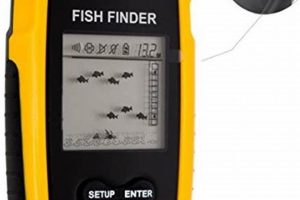
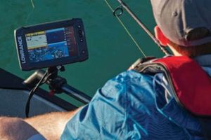
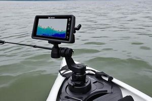
Compact sonar and navigation units designed for small watercraft combine location tracking with the ability to locate fish and underwater structures. These devices typically feature a transducer that emits sonar pulses to determine depth and identify objects beneath the surface. This information, along with GPS data, is displayed on a screen, providing anglers with a real-time view of the underwater environment and their position on the water. An example includes a unit mounted on a kayak’s deck, displaying water depth, fish icons, and a map showing the kayak’s location within a lake.
These integrated systems offer significant advantages for kayak anglers. Knowing the water’s depth and the presence of fish or underwater structures like drop-offs or vegetation significantly increases the chances of a successful fishing trip. GPS functionality ensures safe navigation, particularly in unfamiliar waters or challenging conditions. This combined technology empowers anglers to explore further, locate productive fishing spots, and return safely, representing a substantial advancement over traditional methods. Previously, anglers relied heavily on experience, printed maps, and basic sonar, limiting their range and efficiency.
Further exploration of this topic will cover various aspects including types of units, key features to consider, installation procedures, operational tips, and popular models available on the market.
Tips for Utilizing Kayak Fish Finder GPS Units
Effective use of fish finder GPS systems enhances angling success and improves overall safety on the water. The following tips offer guidance for maximizing the benefits of these devices.
Tip 1: Transducer Placement is Key: Correct transducer placement ensures accurate readings. Mounting the transducer too low may result in interference from the kayak’s hull. Positioning it too high can lead to aeration and loss of signal. Follow manufacturer instructions for optimal placement.
Tip 2: Learn the Display: Familiarization with the unit’s display and various settings is essential. Understanding how to interpret sonar readings, navigate menus, and customize settings allows for efficient use on the water.
Tip 3: Utilize Waypoints: Marking productive fishing spots or navigation hazards with waypoints allows for easy return to specific locations. This feature is particularly useful for tracking successful fishing areas or marking safe passage routes.
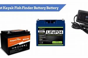
Tip 4: Monitor Battery Levels: Fish finder GPS units consume power. Regularly checking battery levels prevents unexpected shutdowns, especially during longer trips. Carrying a backup power source is recommended.
Tip 5: Adjust Sensitivity: Adjusting the sonar sensitivity can improve performance in different water conditions. Higher sensitivity may be needed in deeper water or when targeting smaller fish. Lower sensitivity helps reduce clutter in shallow water or areas with heavy vegetation.
Tip 6: Consider Mapping Software: Some units offer compatibility with detailed mapping software or charts. Loading maps of specific fishing areas enhances navigation and allows for better understanding of underwater terrain.
Tip 7: Regular Software Updates: Manufacturers often release software updates that improve performance, add features, or fix bugs. Keeping the unit’s software up-to-date ensures optimal functionality.
By following these tips, users can maximize the effectiveness of their fish finder GPS systems. This ultimately leads to a safer and more productive fishing experience.
This information provides a comprehensive understanding of effectively using these units. The following section will conclude with final thoughts and considerations.
1. Portability
Portability is a critical factor in the design and functionality of fish finder GPS units for kayaks. Kayaks, by their nature, prioritize lightweight and compact gear. A bulky, cumbersome fish finder would hinder maneuverability and overall kayak performance. Therefore, manufacturers focus on creating units that are easily transportable and installable on kayaks. This emphasis on portability manifests in several ways, including compact form factors, lightweight materials, and integrated mounting systems. For instance, many units feature quick-release mounts that allow for easy removal and storage when transporting the kayak. Foldable displays further enhance portability.
The portability of these units extends beyond physical dimensions. Battery life directly influences portability in terms of power management. A unit with short battery life requires frequent charging or carrying bulky external batteries, reducing overall portability. Units designed with efficient power consumption allow for longer operation on a single charge, enhancing portability for extended fishing trips. Integrated battery systems further streamline portability by eliminating the need for separate battery packs and associated wiring. This integrated design reduces clutter and simplifies setup on the kayak.
In summary, portability in kayak fish finder GPS units is crucial for maintaining the agility and efficiency of kayak fishing. Manufacturers address this need through compact designs, lightweight materials, efficient power management, and integrated systems. Choosing a portable unit enhances the overall kayak fishing experience by minimizing weight and maximizing on-the-water functionality. Understanding the interplay between portability and performance allows for informed decisions when selecting a fish finder GPS unit best suited for individual kayak fishing needs.
2. Durability
Durability is paramount for electronic devices subjected to the rigors of kayak fishing. Constant exposure to water, direct sunlight, and potential impacts necessitates robust construction. A fish finder GPS designed for kayak use must withstand these challenges to provide reliable performance and longevity. Compromised durability can lead to malfunction, data loss, and ultimately, a jeopardized fishing trip.
- Water Resistance:
Units intended for kayak fishing require a high degree of water resistance, ideally meeting IPX7 standards or higher. This rating signifies the unit’s ability to withstand temporary submersion. A waterproof seal protects internal components from moisture damage, ensuring functionality even in challenging conditions such as heavy rain or accidental capsizing. Units lacking sufficient water resistance are prone to failure in these common kayak fishing scenarios.
- Impact Protection:
Kayaks often navigate shallow waters or areas with submerged obstacles. Accidental impacts can occur, potentially damaging sensitive electronic equipment. Durable units feature ruggedized casing and reinforced screens to withstand minor collisions. Shock-absorbing mounts further protect the unit by mitigating the force of impacts. A lack of impact protection increases the risk of damage, rendering the unit unusable.
- UV Resistance:
Prolonged exposure to sunlight can degrade materials and affect the performance of electronic displays. Durable fish finder GPS units incorporate UV-resistant materials in their construction, preserving the integrity of the casing and ensuring screen readability over time. Without UV protection, the unit may become brittle and the screen may fade, diminishing its usability.
- Temperature Tolerance:
Kayak fishing often takes place in varying temperature conditions. Units designed for durability operate reliably across a wide temperature range, from freezing conditions to intense heat. This tolerance ensures consistent performance regardless of environmental fluctuations. Units lacking temperature tolerance may malfunction or experience reduced battery life in extreme temperatures.
These facets of durability collectively contribute to the reliability and longevity of a fish finder GPS unit in the demanding kayak fishing environment. Selecting a unit built to withstand these challenges ensures consistent performance and a worthwhile investment for serious kayak anglers. Ultimately, durable construction minimizes the risk of equipment failure, allowing anglers to focus on the fishing experience.
3. Battery Life
Battery life is a critical consideration for kayak fish finder GPS units. Extended trips on the water necessitate reliable power for consistent operation. Insufficient battery life can curtail fishing time, limit exploration, and potentially compromise safety. Understanding the factors influencing battery consumption and adopting strategies for power management are essential for maximizing time on the water.
- Power Consumption Factors:
Several factors influence battery drain. Screen brightness, sonar frequency, and GPS usage all contribute to power consumption. Higher screen brightness improves visibility but consumes more power. Increased sonar frequency provides detailed readings but also drains the battery faster. Continuous GPS tracking is power-intensive. Understanding these factors allows users to adjust settings to optimize battery performance based on specific needs.
- Battery Capacity and Type:
Battery capacity, typically measured in milliampere-hours (mAh), determines the potential operational duration. Higher capacity batteries offer longer runtimes. Lithium-ion batteries are common due to their high energy density and relatively low weight. Lead-acid batteries offer lower cost but are heavier and less energy-dense. Choosing the appropriate battery type and capacity is crucial for balancing performance and weight on a kayak.
- Power-Saving Strategies:
Employing power-saving strategies can extend battery life. Reducing screen brightness when feasible, utilizing standby mode during inactive periods, and limiting continuous GPS tracking when unnecessary conserve power. Carrying a backup power source, such as a portable power bank or spare battery, provides a contingency plan for extended trips or unexpected power drain.
- External Power Options:
Some fish finder GPS units offer the ability to connect to external power sources. This option allows for extended operation without relying solely on internal batteries. Kayak anglers can utilize dedicated marine batteries or portable power stations to power their units for multi-day trips or extended use. External power connections offer flexibility for managing power needs during prolonged excursions.
Effective battery management is crucial for maximizing the utility of a fish finder GPS unit on a kayak. Understanding the factors influencing power consumption, choosing an appropriate battery type and capacity, and employing power-saving strategies ensure uninterrupted operation during extended fishing trips. Reliable power enables anglers to fully utilize their fish finder GPS units, maximizing both fishing success and safety on the water.
4. Transducer Type
Transducer selection significantly impacts the performance of fish finder GPS systems in kayak fishing. The transducer acts as the system’s eyes underwater, transmitting and receiving sonar signals. Different transducer types offer varying capabilities regarding frequency, cone angle, and mounting options. These variations influence the clarity, range, and overall effectiveness of the fish finder. Choosing the correct transducer type is crucial for maximizing the system’s potential and achieving desired fishing outcomes.
Several transducer types are commonly used with kayak fish finders. Single-frequency transducers emit sonar pulses at a single frequency, typically 200 kHz for deeper water or 83 kHz for shallower areas. Dual-frequency transducers offer greater versatility by switching between these frequencies, optimizing performance for varying depths. CHIRP (Compressed High-Intensity Radiated Pulse) transducers emit a range of frequencies simultaneously, resulting in higher resolution imagery and improved target separation compared to single or dual-frequency models. Side-imaging transducers use multiple beams to create detailed images of the underwater environment to the sides of the kayak. Each transducer type presents distinct advantages and disadvantages for specific fishing applications and environments. For example, a CHIRP transducer provides detailed information about bottom structure and fish location in deeper water, while a side-imaging transducer excels at locating fish hiding near structures or in vegetated areas.
The transducer’s mounting location on the kayak also influences performance. Transom-mount transducers attach to the kayak’s stern. In-hull transducers are mounted inside the hull, offering protection but potentially reduced sensitivity. Trolling motor transducers integrate with the trolling motor, providing convenient deployment and retrieval. Matching the transducer type and mounting location to the kayak’s design and the intended fishing environment is essential for optimal performance. Careful consideration of these factors ensures accurate readings, efficient operation, and ultimately, a more successful fishing experience. Failure to select the appropriate transducer can result in poor sonar performance, limiting the angler’s ability to locate fish and understand underwater structures effectively.
5. Screen size/resolution
Screen size and resolution play crucial roles in the effectiveness of fish finder GPS units designed for kayaks. These factors directly influence the clarity and interpretability of displayed information, impacting an angler’s ability to understand underwater terrain, locate fish, and navigate effectively. A larger screen with higher resolution presents more data clearly, allowing for easier identification of subtle details. Conversely, a smaller, lower-resolution screen can make it difficult to discern critical information, hindering fishing success and potentially compromising navigational safety.
Consider a scenario where an angler is searching for fish near a complex underwater structure. A high-resolution display allows for clear differentiation between fish, rocks, and vegetation. This clarity enables precise targeting and reduces wasted casts in unproductive areas. On a smaller, lower-resolution screen, these details might blur together, making it challenging to identify fish and potentially leading to frustration and reduced effectiveness. Similarly, navigating complex waterways requires a clear view of charts and GPS data. A larger, high-resolution screen simplifies route planning and enhances situational awareness, particularly in challenging conditions. A small, low-resolution screen can make it difficult to follow a planned route, increasing the risk of navigational errors.
The practical significance of screen size and resolution extends beyond immediate functionality. Eye strain becomes a factor during prolonged use, particularly in bright sunlight. Larger, higher-resolution screens often feature adjustable brightness and contrast settings, enhancing visibility and reducing eye fatigue. This is crucial for maintaining focus and situational awareness during long hours on the water. Ultimately, selecting a fish finder GPS unit with appropriate screen size and resolution enhances the overall kayaking experience, promoting both fishing success and safety through improved data clarity and reduced eye strain. This choice should align with individual needs and preferences, balancing portability with display clarity for optimal performance.
6. Mapping Capabilities
Mapping capabilities significantly enhance the utility of fish finder GPS units in kayak fishing. These features provide anglers with crucial navigational information and detailed underwater contour data, enabling strategic fishing and improved safety on the water. Integrating GPS technology with detailed maps allows for precise location tracking, efficient route planning, and identification of promising fishing areas. Effective use of mapping capabilities contributes significantly to a successful and safe kayak fishing experience.
- Chartplotting and Navigation:
Integrated chartplotting displays navigable waterways, aiding in route planning and safe navigation. Anglers can mark waypoints for points of interest, such as productive fishing spots, navigational hazards, or launch locations. Real-time GPS tracking overlaid on the chart provides continuous positional awareness, enhancing safety and facilitating efficient movement between fishing areas. This functionality is especially valuable in unfamiliar waters or complex environments.
- Contour Mapping:
Detailed contour maps reveal underwater terrain, including depth variations, drop-offs, channels, and submerged structures. Understanding underwater topography allows anglers to identify likely fish-holding areas, such as underwater ledges, points, or humps. Contour maps provide valuable insights into underwater landscapes, enabling strategic fishing approaches. This data is crucial for locating specific fish species that prefer particular depth ranges or structural features.
- GPS Waypoint Management:
Fish finder GPS units allow for the creation, storage, and management of waypoints. Anglers can mark productive fishing locations, hazards, or other points of interest for future reference. Waypoints facilitate efficient navigation back to previously identified locations, eliminating the need for time-consuming searches. This feature significantly streamlines the process of revisiting successful fishing spots.
- Integration with Mapping Software:
Many fish finder GPS units offer compatibility with specialized mapping software or chart services. This integration expands mapping capabilities beyond basic charts, providing access to detailed bathymetric data, satellite imagery, and other valuable information. Anglers can upload custom maps or download specific charts for targeted fishing areas, enhancing navigational precision and situational awareness. Access to comprehensive mapping resources significantly enhances the planning and execution of fishing trips.
The integration of advanced mapping capabilities transforms fish finder GPS units from simple depth sounders into comprehensive navigational and fish-finding tools. These features empower kayak anglers to navigate safely, locate productive fishing areas efficiently, and ultimately, maximize their time on the water. Effective use of mapping functionalities elevates the kayak fishing experience from basic exploration to strategic pursuit, enhancing both enjoyment and success.
Frequently Asked Questions
Addressing common inquiries regarding kayak fish finder GPS units provides clarity for informed purchasing and operational decisions. The following responses offer practical insights for maximizing the benefits of these devices.
Question 1: What is the typical price range for a suitable kayak fish finder GPS?
Prices vary based on features, brand, and screen size. Suitable units range from approximately $150 to over $1000. Entry-level models provide basic functionality, while high-end options offer advanced features like CHIRP sonar, side-imaging, and detailed mapping capabilities.
Question 2: How is a fish finder GPS powered on a kayak?
Most units utilize rechargeable lithium-ion batteries. Battery life varies depending on usage and settings. Some models offer external power connections for extended operation using marine batteries or portable power stations. Power consumption considerations are crucial for extended trips.
Question 3: Can existing kayak hardware be utilized for mounting a fish finder GPS?
Many kayaks offer pre-installed mounting points or accessory tracks compatible with standard fish finder mounts. Aftermarket mounting solutions are available for kayaks lacking dedicated mounting options. Careful consideration of mounting location optimizes transducer performance and display visibility.
Question 4: What transducer type is recommended for kayak fishing?
Transducer choice depends on fishing style and target species. CHIRP transducers offer excellent detail and target separation. Side-imaging transducers excel at locating structure and fish in shallow water. Traditional single or dual-frequency transducers provide cost-effective solutions for general-purpose use. Water conditions and target depth also influence transducer selection.
Question 5: Is professional installation recommended for fish finder GPS units on kayaks?
While professional installation is available, most kayak anglers can install these units themselves. Following manufacturer instructions ensures proper wiring, transducer placement, and optimal performance. Basic technical skills are sufficient for most installations. If unsure, consult online resources or seek assistance from experienced kayak anglers.
Question 6: How does mapping software enhance the functionality of these units?
Mapping software provides detailed charts, bathymetric data, and satellite imagery. This information enhances navigation, facilitates route planning, and allows anglers to identify promising fishing areas based on underwater terrain and structure. Integrated GPS data overlaid on maps provides precise location awareness and improves overall situational awareness.
Understanding these key aspects facilitates informed decisions regarding fish finder GPS selection and utilization. Careful consideration of individual needs and preferences ensures a positive and productive kayak fishing experience.
The subsequent section will offer concluding remarks and recommendations regarding fish finder GPS units for kayaks.
Conclusion
Fish finder GPS units represent a significant technological advancement for kayak anglers. This exploration has covered key aspects, including the importance of portability and durability in challenging kayak fishing environments. Battery life considerations, transducer selection based on fishing style and target species, and the impact of screen size and resolution on data interpretation were also discussed. Furthermore, the significant role of mapping capabilities in enhancing navigation and strategic fishing was highlighted. Understanding these elements allows for informed decisions regarding unit selection and effective utilization.
Careful consideration of these factors empowers anglers to choose the most suitable fish finder GPS unit. This technology offers a powerful tool for enhancing fishing success and promoting safe navigation on the water. Ultimately, leveraging the capabilities of fish finder GPS technology contributes to a more informed, efficient, and enjoyable kayak fishing experience.

