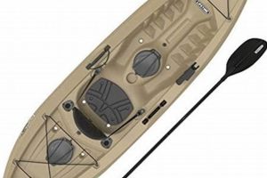
A high-quality, waterproof global positioning system designed for the specific demands of angling from a kayak offers significant advantages. Such devices typically integrate features like chartplotting, sonar capabilities for identifying fish and underwater structures, and often include specialized functionalities like marking waypoints for productive fishing spots or tracking routes. Compact and portable designs, coupled with robust mounting options suitable for kayak environments, are essential characteristics.
Accurate navigation and enhanced situational awareness are vital for safe and successful kayak fishing excursions. These specialized units enable anglers to pinpoint locations, navigate challenging waters, and return safely to launch points, particularly in low-light conditions or unfamiliar territories. The ability to locate fish-holding structures and track previously successful fishing spots significantly increases angling efficiency. Historically, kayak anglers relied on basic compasses and paper charts. Modern GPS technology represents a significant advancement, providing real-time data and improved decision-making tools for a more rewarding on-the-water experience.
Key considerations for selecting a suitable unit include screen size and readability in sunlight, battery life, mapping detail, and the integration of supplementary features like tide charts and weather forecasts. The following sections will delve into the specific attributes of leading models, discuss essential features, and provide guidance on choosing the optimal device for individual angling needs and budgets.
Tips for Selecting and Utilizing Kayak Fishing GPS Devices
Choosing and effectively using a GPS device specifically designed for kayak fishing can significantly enhance safety and angling success. These tips offer guidance on maximizing the benefits of such technology.
Tip 1: Prioritize Waterproofing and Durability: Kayak fishing exposes electronics to harsh conditions including water spray, submersion, and impacts. Selecting a device with a high waterproof rating (IPX7 or higher) is essential. Rugged construction designed to withstand drops and impacts is also highly recommended.
Tip 2: Evaluate Screen Size and Readability: Sunlight glare can render even bright screens difficult to read. Opt for a device with a transflective display optimized for outdoor visibility. A larger screen size also facilitates easier navigation and data interpretation.
Tip 3: Consider Battery Life: Extended fishing trips require a device with sufficient battery capacity. Examine battery life specifications and consider carrying a portable power bank for recharging in the field.
Tip 4: Assess Mapping Detail and Coverage: Ensure the device offers detailed charts of the intended fishing areas, including bathymetry data, points of interest, and navigational aids. Compatibility with downloadable or updatable charts provides added flexibility.
Tip 5: Explore Sonar Integration: Integrated sonar functionality adds a valuable dimension to fish finding and underwater structure identification. Consider the transducer type and frequency for optimal performance in specific fishing environments.
Tip 6: Learn Essential Features: Familiarize oneself with the device’s core functionalities, including waypoint marking, route planning, and track logging. Practice using these features prior to venturing onto the water.
Tip 7: Mount Securely and Strategically: Utilize a robust mounting system specifically designed for kayak use. Position the device within easy reach and clear line of sight for safe and efficient operation.
By carefully considering these factors, anglers can select and utilize a GPS device that enhances safety, improves navigation, and ultimately increases the likelihood of a successful fishing experience.
Equipped with the right tools and knowledge, kayak anglers can confidently explore new waters and maximize their time on the water.
1. Waterproof and Rugged Design
The demanding environment of kayak fishing necessitates electronic devices built to withstand significant water exposure and potential impacts. A waterproof and rugged design is not simply a desirable feature; it is a fundamental requirement for a GPS unit to function reliably and provide consistent performance over time. Durability directly impacts the longevity and overall value of the investment.
- Ingress Protection (IP) Ratings:
The IP rating system provides a standardized measure of a device’s resistance to solids and liquids. For kayak fishing, a minimum rating of IPX7 is recommended, signifying protection against temporary submersion. Higher ratings, such as IPX8, indicate greater protection against continuous submersion at greater depths. This rating system offers consumers a quantifiable metric for evaluating waterproofness.
- Impact and Shock Resistance:
Kayaks are often subject to impacts, whether from accidental drops, collisions with submerged objects, or rough handling during transport. A rugged design incorporating shock-absorbing materials and robust construction safeguards internal components, preventing damage from these inevitable occurrences. Reinforced casings and specialized screen protectors contribute to overall device longevity.
- Temperature Tolerance:
Exposure to extreme temperatures, both hot and cold, can negatively impact electronic performance. GPS units designed for kayak fishing should exhibit resilience to fluctuating temperatures, maintaining consistent operation in both direct sunlight and cold water conditions. This temperature resilience ensures accurate data acquisition and display regardless of ambient conditions.
- Material Selection and Construction:
The choice of materials and construction methods significantly influences a GPS device’s overall durability. High-impact plastics, corrosion-resistant metals, and specialized sealing techniques contribute to a robust design. Examining the construction details provides insight into the manufacturer’s commitment to long-term reliability and performance.
Investing in a GPS device with a genuinely waterproof and rugged design is paramount for kayak anglers. This durability ensures reliable performance in challenging environments, extends the lifespan of the device, and ultimately contributes to a safer and more productive fishing experience. While other features contribute to a positive user experience, a robust design forms the foundation upon which all other functionalities rely.
2. Sunlight-Readable Display
Effective navigation and data interpretation are critical for successful kayak fishing. A sunlight-readable display ensures crucial information remains visible even under intense glare, a common challenge on open water. This factor significantly influences usability and safety, impacting an angler’s ability to make informed decisions based on real-time GPS data.
- Transflective Technology:
Transflective displays utilize ambient light to enhance screen visibility in bright conditions. Unlike traditional backlit screens, which can be washed out by sunlight, transflective technology reflects external light back through the display, increasing contrast and readability. This technology is essential for clear visibility in direct sunlight.
- Screen Brightness and Contrast:
High screen brightness, coupled with optimized contrast ratios, further improves visibility under challenging lighting conditions. Manufacturers often specify brightness in nits (cd/m). Higher nit values generally translate to better visibility in sunlight. Effective contrast differentiates between foreground elements and background information, enhancing readability.
- Anti-Glare Coatings:
Specialized anti-glare coatings minimize reflections from the water’s surface or other environmental light sources, further reducing glare and enhancing screen clarity. These coatings effectively diffuse reflected light, improving visibility and reducing eye strain. This is particularly beneficial in bright, open-water environments.
- Color Schemes and Data Presentation:
Effective color schemes and data presentation play a crucial role in optimizing readability. High-contrast color combinations, coupled with clear and uncluttered data presentation, ensure information is readily discernible at a glance. Minimizing unnecessary on-screen elements reduces visual clutter, allowing anglers to quickly assimilate critical navigational and fish-finding data.
The ability to readily access GPS data, including location, navigation routes, and fish-finding information, is essential for successful kayak fishing. A sunlight-readable display ensures this information remains accessible and readily interpretable even in bright sunlight, contributing significantly to both safety and angling effectiveness. Choosing a GPS unit with a display specifically designed for outdoor visibility is a critical factor for maximizing on-the-water performance.
3. Long Battery Life
Extended battery life is a critical factor in determining the suitability of a GPS device for kayak fishing. Anglers often spend hours on the water, and a device with inadequate battery capacity can jeopardize navigation, communication, and safety. Dependence on a GPS unit for position awareness, particularly in unfamiliar waters or during challenging weather conditions, necessitates reliable power for extended durations. The inability to determine one’s location due to a depleted battery poses significant risks. A device’s battery life directly impacts the angler’s ability to focus on fishing rather than managing power consumption.
Consider a scenario where an angler kayaks to a remote fishing spot early in the morning. A GPS unit with limited battery life might fail to provide crucial navigational guidance during the return trip in late afternoon or evening, especially if features like sonar or backlighting have been utilized extensively. This scenario underscores the practical implications of insufficient battery capacity. Manufacturers typically specify battery life under ideal conditions. Real-world usage, often involving varying temperatures and screen brightness settings, usually results in shorter operating times than advertised. Therefore, opting for a device with a generous battery life margin provides a crucial safety buffer.
The importance of long battery life extends beyond mere convenience. It directly influences safety and the overall fishing experience. Anglers should carefully consider battery capacity, power-saving features, and the potential for carrying backup power sources when selecting a GPS unit for kayak fishing. Understanding the direct correlation between battery life and on-the-water safety allows for informed decision-making and contributes to more enjoyable and productive fishing excursions.
4. Accurate Mapping/Charting
Comprehensive and accurate mapping data is fundamental to the effectiveness of a GPS unit designed for kayak fishing. Detailed charts provide crucial navigational information, enhance situational awareness, and contribute significantly to both safety and angling success. Understanding the nuances of mapping data and its application in a kayak fishing context is essential for informed device selection and optimal utilization.
- Bathymetric Data:
Bathymetric charts depict underwater terrain, revealing depth contours, drop-offs, channels, and other underwater structures. This information is invaluable for locating fish-holding areas, navigating safely through shallow waters, and understanding the underwater landscape. Identifying a submerged reef or a sharp depth change can be the difference between finding a productive fishing spot and returning empty-handed. Bathymetric data provides kayak anglers with a crucial underwater perspective.
- Navigational Aids and Obstacles:
Accurate charts display navigational aids such as buoys, markers, and channel markings, enabling safe navigation through complex waterways. They also identify potential hazards like submerged rocks, wrecks, and other obstructions that could pose a risk to kayakers. Awareness of these navigational elements is particularly crucial in low-visibility conditions or unfamiliar areas, contributing significantly to safe passage and collision avoidance.
- Points of Interest (POIs):
Charts often include points of interest relevant to anglers, such as boat ramps, marinas, fishing access points, and known fishing hotspots. This information simplifies trip planning and facilitates efficient navigation to desired locations. Quickly locating a nearby boat ramp during inclement weather or identifying a known fishing area can significantly enhance the overall fishing experience.
- Chart Updates and Accuracy:
Waterways are dynamic environments subject to change. Regular chart updates are essential to maintain accuracy and reflect alterations in underwater terrain, navigational aids, and other relevant features. Using outdated charts can lead to navigational errors and potentially dangerous situations. Ensuring access to the most current chart data is crucial for safe and effective kayak fishing. Some GPS units offer subscription services for automatic chart updates, ensuring access to the latest information.
The quality and accuracy of mapping data directly impact the overall utility of a GPS device for kayak fishing. Detailed charts empower anglers to make informed decisions, navigate safely, and locate productive fishing areas. Understanding the various facets of mapping data and its application in a kayak fishing context allows for informed device selection and contributes to a safer and more rewarding on-the-water experience. Selecting a GPS unit with comprehensive charting capabilities specifically designed for marine environments is paramount for maximizing the benefits of this essential technology.
5. Integrated Sonar Capability
Integrated sonar capability significantly enhances the utility of GPS devices specifically designed for kayak fishing. Sonar technology provides real-time underwater insights, enabling anglers to identify fish, locate structures, and understand bottom composition. This functionality transforms a GPS unit from a simple navigational tool into a sophisticated fish-finding system. The integration of sonar directly addresses the core objective of kayak fishing: locating and catching fish effectively. By providing a clear image of the underwater environment, integrated sonar empowers anglers to make informed decisions about where to cast their lines, significantly increasing the likelihood of success. Consider a scenario where an angler is navigating a shoreline with submerged vegetation. Integrated sonar allows for visualization of these underwater structures, revealing potential ambush points for predatory fish. Without sonar, these prime fishing locations might remain hidden.
The practical significance of integrated sonar extends beyond simply locating fish. Understanding bottom hardness, identifying drop-offs, and pinpointing submerged debris provides valuable context for lure selection and presentation. For instance, a hard bottom might suggest the use of bottom-bouncing lures, while a soft, muddy bottom might necessitate a different approach. Similarly, identifying thermoclines, or temperature gradients in the water column, often revealed through sonar data, can be crucial for locating specific fish species that prefer particular temperature ranges. This detailed underwater intelligence elevates angling strategy beyond simple guesswork, promoting more efficient and productive fishing sessions.
Integrating sonar into a kayak fishing GPS unit presents certain technical challenges. Transducer placement and mounting must consider the unique hydrodynamic characteristics of a kayak to minimize interference and ensure accurate readings. Signal interpretation requires practice and understanding of the nuances of sonar data visualization. However, the benefits of integrated sonar, when effectively utilized, significantly outweigh these challenges, transforming a GPS unit into an indispensable tool for the serious kayak angler. This integration directly contributes to a more informed, efficient, and ultimately successful fishing experience.
6. User-Friendly Interface
A user-friendly interface is paramount for a GPS device designed for kayak fishing. Rapid access to critical information, especially in dynamic on-the-water environments, is essential for both safety and effective angling. A cluttered or complex interface can distract an angler, hindering quick decision-making and potentially compromising safety. Intuitive operation allows users to focus on the fishing experience rather than struggling with complicated menus or obscure functionalities. An effective interface simplifies interaction with the device, allowing for efficient access to essential features.
- Intuitive Menu Structure:
A logically organized menu structure, with clearly labeled options and minimal sub-menus, facilitates quick access to desired functions. Searching through multiple layers of menus to locate a specific setting, such as adjusting sonar sensitivity or marking a waypoint, can be frustrating and time-consuming. A well-designed interface presents essential features prominently, minimizing the need for extensive menu navigation. For example, dedicating physical buttons to frequently accessed features like zoom or waypoint marking streamlines operation, particularly in situations requiring rapid adjustments.
- Clear Data Presentation:
Data should be presented in a clear, concise, and easily interpretable format. Uncluttered screens with logically organized information elements, such as map displays, sonar readings, and navigational data, minimize cognitive load and facilitate rapid assessment of the current situation. Effective use of color coding, intuitive icons, and logically grouped data points contributes to enhanced readability and comprehension. For instance, differentiating navigational waypoints from fish-finding waypoints through distinct visual cues simplifies on-screen interpretation.
- Customizable Data Fields:
The ability to customize data fields allows anglers to prioritize the information most relevant to their specific needs and fishing style. Displaying preferred data points, such as water temperature, speed over ground, or battery level, directly on the main screen minimizes the need to navigate through menus. This customization enhances efficiency and allows anglers to focus on the most critical information for their current situation. For example, an angler trolling for specific species might prioritize water temperature and depth, while another angler casting near shore might prioritize bottom structure and GPS coordinates.
- Responsive Touchscreen or Button Controls:
Whether a touchscreen or physical buttons, the control interface must be responsive and reliable, even with wet hands or in challenging weather conditions. A laggy touchscreen or stiff buttons can be frustrating and hinder quick adjustments. Gloves worn for warmth can further complicate interaction with small buttons or unresponsive touchscreens. A well-designed interface considers these real-world conditions, ensuring reliable operation regardless of environmental factors. For example, tactile buttons with positive feedback offer reliable operation even when wearing gloves, whereas capacitive touchscreens may struggle in cold or wet conditions.
A user-friendly interface is not merely a desirable feature; it is a critical element of a high-quality GPS device for kayak fishing. It directly impacts usability, safety, and the overall fishing experience. By prioritizing intuitive operation and clear data presentation, manufacturers empower anglers to focus on what matters most: enjoying their time on the water and maximizing their chances of angling success. The ability to efficiently interact with a GPS unit contributes significantly to a safer, more productive, and ultimately more rewarding kayak fishing experience.
7. Reliable Mounting Options
Secure and accessible mounting is crucial for maximizing the utility of a GPS device in the demanding environment of kayak fishing. The dynamic nature of kayaking, with its inherent movement and potential for water exposure, necessitates mounting solutions that prioritize both stability and ease of access. A poorly mounted device can become dislodged, damaged, or simply difficult to view, negating its benefits and potentially creating a hazardous distraction. Reliable mounting options directly contribute to the overall safety and effectiveness of using a GPS during kayak fishing excursions.
Consider the scenario of navigating through challenging currents or encountering unexpected waves. A securely mounted GPS remains readily accessible, providing crucial navigational information without requiring the angler to remove hands from the paddle or compromise stability. Conversely, a loosely mounted device might shift or detach entirely, hindering navigation and potentially creating a dangerous situation. Various mounting options exist, each with specific advantages and disadvantages. Flush mounts integrate seamlessly with the kayak’s deck, minimizing interference with paddling and offering a clean, streamlined profile. Articulating mounts provide adjustable viewing angles, accommodating diverse seating positions and lighting conditions. Rail mounts attach to existing kayak rails, offering convenient installation and removal. The optimal mounting solution depends on individual kayak configuration, fishing style, and personal preferences. Factors to consider include the device’s size and weight, the kayak’s layout, and the angler’s preferred viewing angle. Compatibility between the mounting system and the GPS unit is also crucial for ensuring a secure and stable attachment.
Selecting a robust mounting system, specifically designed for marine environments, is a critical aspect of equipping a kayak for fishing with GPS technology. This seemingly minor detail can significantly impact the overall experience, contributing to safety, enhancing usability, and ensuring the GPS unit remains a valuable tool rather than a potential liability. Understanding the importance of reliable mounting options empowers anglers to make informed decisions, maximizing the benefits of GPS technology and promoting a safer and more productive kayak fishing experience.
Frequently Asked Questions
This section addresses common inquiries regarding GPS units designed for kayak fishing, providing concise and informative responses to facilitate informed decision-making.
Question 1: What differentiates a kayak fishing GPS from a standard handheld GPS unit?
Kayak fishing GPS units typically incorporate features specifically tailored to the needs of anglers, such as integrated sonar, waterproof and ruggedized construction, specialized mapping data including bathymetry and fishing charts, and mounting systems designed for kayak environments. Standard handheld GPS units may lack these specialized features.
Question 2: How crucial is integrated sonar for kayak fishing?
Integrated sonar significantly enhances fish-finding capabilities by providing real-time underwater views, revealing fish locations, bottom structure, and other relevant information. While not strictly essential, sonar greatly improves angling efficiency, particularly in unfamiliar waters or when targeting specific species.
Question 3: Can a smartphone effectively replace a dedicated kayak fishing GPS?
While smartphones offer GPS functionality and charting apps, they often lack the ruggedness, battery life, and specialized features of dedicated kayak fishing GPS units. Water resistance and sunlight readability are also crucial considerations often lacking in standard smartphone designs.
Question 4: What mapping features are most important for kayak anglers?
Detailed bathymetric charts revealing underwater terrain, accurate navigational aids, points of interest relevant to fishing, and regularly updated chart data are essential mapping features for kayak anglers. These data contribute significantly to both safety and angling success.
Question 5: How does screen size influence the usability of a kayak fishing GPS?
Larger screens generally enhance readability and facilitate data interpretation, particularly in bright sunlight or when navigating complex waterways. However, larger screens can also increase device size and weight, factors to consider in the context of kayak space constraints.
Question 6: What factors influence GPS battery life, and how can it be maximized?
Screen brightness, sonar usage, and ambient temperature significantly influence battery consumption. Reducing screen brightness, limiting sonar usage when unnecessary, and utilizing power-saving modes can extend battery life. Carrying a portable power bank provides a backup power source for extended trips.
Careful consideration of these frequently asked questions empowers prospective purchasers to evaluate available options effectively, ensuring the selected GPS unit aligns with individual needs and priorities. Investing in a suitable device significantly enhances safety, improves navigational efficiency, and ultimately contributes to a more rewarding kayak fishing experience.
For further insights and detailed reviews of specific GPS models, continue to the next section.
Conclusion
Selecting a high-quality GPS designed for kayak fishing requires careful evaluation of key features directly impacting safety and angling success. Durable construction, sunlight-readable displays, extended battery life, accurate mapping with bathymetric detail, and integrated sonar capabilities are crucial considerations. A user-friendly interface simplifies operation in dynamic on-the-water environments, while reliable mounting options ensure secure device placement. Prioritizing these factors empowers informed purchasing decisions tailored to individual angler requirements and budgetary constraints.
An effective GPS unit transforms kayak fishing, enhancing navigational safety, improving fishing efficiency, and ultimately contributing to a more rewarding experience on the water. Careful consideration of the features discussed herein empowers anglers to select the optimal technology for their specific needs, unlocking the full potential of kayak angling and fostering a deeper connection with the aquatic environment.

