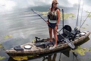
Navigational satellite technology integrated into handheld devices, fish finders, and chartplotters provides location data, mapping capabilities, and often fish-finding sonar for anglers in kayaks. This technology offers precise positioning on the water, allowing users to mark waypoints such as productive fishing spots, navigational hazards, or launch locations. A modern chartplotter, for example, displays detailed maps, tracks movement, and can overlay sonar data onto the map for a comprehensive view of the underwater environment.
The ability to pinpoint and return to successful fishing areas, navigate safely in unfamiliar waters, and understand underwater structures greatly enhances angling success and safety. Before such technology, kayak anglers relied heavily on printed maps, compasses, and personal knowledge, making navigation more challenging and time-consuming. Modern systems streamline the process, allowing more time for fishing and exploration while improving situational awareness and safety on the water. This is particularly beneficial in large bodies of water, complex waterways, or areas with changing tides and currents.
This article will further explore the various types of devices available, key features to consider when selecting a unit, installation and usage tips, and the impact of these technologies on modern kayak fishing techniques.
Effective use of navigational aids contributes significantly to successful and safe kayak fishing excursions. The following tips offer guidance for maximizing the benefits of these technologies.
Tip 1: Prioritize Waterproofing and Floatation: Electronic devices should be waterproof and, ideally, secured with a floating lanyard or housed in a waterproof case. Accidental submersion is a common occurrence in kayaking.
Tip 2: Pre-Trip Planning and Route Mapping: Utilize mapping software to plan routes, mark potential fishing spots, and identify navigational hazards before embarking on a trip. This allows for efficient time management on the water.
Tip 3: Regular Battery Checks and Backup Power: Ensure devices are fully charged before each trip and carry a backup power source or charging solution. Battery life can be significantly impacted by usage and temperature.
Tip 4: Understanding Chart Datum and Map Updates: Be aware of the chart datum used by the navigational system and ensure charts are up-to-date to avoid discrepancies between charted depths and actual water depths.
Tip 5: Mark Waypoints Strategically: Mark waypoints for productive fishing areas, points of interest, and launch/landing locations. Organized waypoint management facilitates efficient navigation and revisiting successful spots.
Tip 6: Integrate Sonar Data with Mapping: If using a fish finder or chartplotter with sonar capabilities, learn to interpret sonar readings in conjunction with map data to identify underwater structures and fish-holding areas.
Tip 7: Account for Tides and Currents: Be mindful of tidal fluctuations and currents, particularly in coastal or riverine environments. Navigational systems can assist in tracking these changes, but understanding their impact on kayak movement is crucial.
By adhering to these guidelines, anglers can enhance their situational awareness, improve fishing success, and ensure a safer experience on the water.
These tips offer a foundation for safe and productive kayak fishing with navigational technology. The subsequent conclusion will summarize the key takeaways and reinforce the importance of responsible and informed use of these tools.
Precise navigation is paramount in kayak fishing, enabling anglers to efficiently locate fishing grounds, navigate safely through complex waterways, and return consistently to productive spots. GPS technology has revolutionized navigational capabilities for kayak anglers, providing previously unavailable levels of accuracy and situational awareness on the water.
- Pinpoint Location and Tracking:
GPS receivers provide real-time location data, allowing anglers to understand their precise position on the water. This eliminates the uncertainties of traditional navigation methods. Tracking capabilities allow for recording routes, measuring distances covered, and monitoring speed, valuable information for optimizing fishing strategies and understanding fish movement patterns. For example, tracking drift speed in a current can inform bait presentation techniques.
- Chart Plotting and Route Planning:
Electronic charts displayed on GPS devices or chartplotters provide detailed maps of waterways, including depth contours, navigational markers, and potential hazards. Anglers can pre-plan routes, mark waypoints for future reference, and navigate confidently to chosen locations, even in unfamiliar waters. This feature is particularly valuable in low-visibility conditions or when navigating complex shorelines.
- Waypoint Management:
The ability to save specific locations as waypoints is a cornerstone of GPS navigation for fishing. Anglers can mark productive fishing spots, structure like reefs or drop-offs, or locations of interest like submerged debris. Returning to these marked locations becomes effortless, eliminating the need to rely on memory or less precise methods. This feature is particularly valuable for revisiting successful fishing spots or navigating to known hazards.
- Integration with Other Technologies:
Modern GPS systems often integrate seamlessly with fish finders, sonar, and even weather forecasting services. This integration provides a comprehensive view of the fishing environment. Anglers can overlay sonar data onto navigation charts to identify underwater structures and potential fish-holding areas. Weather information overlaid on the map provides real-time updates, enabling anglers to make informed decisions about safety and fishing strategy.
These navigational capabilities offered by GPS technology significantly enhance the efficiency and safety of kayak fishing. The ability to precisely navigate, track movement, plan routes, and integrate with other fishing technologies provides a significant advantage for anglers, allowing them to focus on the art of fishing while minimizing the challenges of traditional navigation.
2. Safety
Safety is paramount in kayak fishing, and GPS technology plays a crucial role in mitigating risks and enhancing angler well-being. The inherent vulnerabilities of kayakingsmall vessel size, proximity to water, and potential exposure to unpredictable weatherunderscore the importance of safety measures. GPS contributes significantly to mitigating these risks through several key functionalities.
Emergency Situations and Location Sharing: In emergencies, a GPS device can provide precise location information for rescue services. Some devices offer dedicated SOS functionalities that transmit distress signals with coordinates. Real-time location sharing features allow others to monitor an angler’s position remotely, providing an added layer of security, particularly in solo trips. This is critical in situations like capsizing, medical emergencies, or unexpected changes in weather. For example, if a kayak overturns in a remote area, a GPS distress signal can pinpoint the location for rapid response. Furthermore, shared location data allows family or friends to know when an angler has deviated from their planned route or has not returned as expected, enabling timely intervention.
Navigation in Challenging Conditions: GPS assists navigation in low visibility situations (fog, darkness) or unfamiliar waters, reducing the risk of disorientation or collisions. Accurate charting and route planning prevent straying into hazardous areas. Tide and current data, often integrated into GPS systems, allow anglers to anticipate changes in water movement, reducing the risk of being swept into dangerous areas. Knowing one’s position relative to known hazards, such as shipping lanes or shallow reefs, greatly enhances navigational safety.
Return to Safety: GPS ensures easy return to launch points, particularly after long drifts or explorations. Marked waypoints provide clear navigational references, reducing the risk of becoming lost. This functionality is invaluable when fatigue sets in or weather conditions deteriorate, ensuring a safe and efficient return to shore.
Integrating GPS technology into kayak fishing significantly elevates safety standards. While inherent risks remain, GPS offers invaluable tools for mitigating these risks and enhancing angler preparedness for unforeseen circumstances. Responsible use of GPS, coupled with sound judgment and adherence to safe boating practices, creates a safer and more enjoyable fishing experience.
3. Fish finding
Effective fish finding is a cornerstone of successful angling. Integrating GPS technology with sonar drastically enhances the kayak angler’s ability to locate and target fish. This combination provides a powerful toolset for understanding underwater environments and pinpointing fish-holding locations, leading to increased angling success. GPS facilitates precise navigation to promising fishing areas while sonar provides real-time imagery of the underwater world.
- Structure Identification:
Sonar technology, often integrated with GPS chartplotters, allows anglers to visualize underwater structures such as reefs, drop-offs, submerged timber, and other features that attract fish. GPS functionality enables marking these locations as waypoints for future reference and precise return navigation. This removes the guesswork involved in locating productive fishing grounds, especially in unfamiliar waters. For example, a kayak angler can use sonar to identify a submerged rock pile, mark its location using GPS, and then repeatedly return to this productive spot.
- Fish School Location and Tracking:
Sonar technology allows for real-time identification and tracking of fish schools. GPS integration enables marking the location of these schools, allowing anglers to effectively target them and monitor their movement patterns. This dynamic combination provides a significant advantage over traditional methods, allowing for precise placement of bait or lures directly within the target zone. Understanding fish movement in relation to underwater structure and depth provides valuable insight into fish behavior.
- Depth Contour Mapping and Interpretation:
GPS chartplotters often feature detailed bathymetric charts, providing information about water depth and bottom contours. Integrating sonar readings allows for a more refined understanding of the underwater terrain, identifying subtle changes in depth or bottom composition that might attract fish. This detailed mapping, combined with the angler’s knowledge of fish habitat preferences, significantly enhances the probability of locating productive fishing areas. For instance, finding a subtle depression or channel on a flat bottom can be a key to locating fish.
- Data Logging and Analysis:
Many modern fish finders and chartplotters allow for logging sonar data and GPS coordinates. This logged information can be analyzed post-trip to identify patterns, understand fish behavior, and refine future fishing strategies. Combining historical sonar data with GPS location information can reveal productive fishing areas over time and enhance the angler’s knowledge of a specific body of water. This analytical approach provides a valuable feedback loop for continuous improvement in fish finding techniques.
The synergy between GPS and sonar technology revolutionizes fish finding in kayak fishing. These combined tools empower anglers to understand the underwater world, identify productive locations, and target fish with unprecedented precision. This strategic approach maximizes fishing success by transforming the search for fish from a chance encounter into a targeted pursuit.
4. Waypoint Marking
Waypoint marking is an integral function of GPS utilization in kayak fishing, enabling efficient navigation and enhancing angling success. It facilitates precise return trips to productive locations, eliminating reliance on less accurate or memory-based navigation. Understanding the facets of waypoint management optimizes the benefits of GPS technology in the kayak fishing experience.
- Marking Productive Fishing Spots:
When a successful fishing location is discovered, marking it as a waypoint ensures effortless return trips. Factors such as water depth, bottom structure, and proximity to cover can influence fish aggregation. Recording these locations through waypoints allows anglers to revisit these productive areas under varying conditions (time of day, tide, etc.), maximizing the potential for repeated success. This eliminates the need to rely on memory or less precise navigational cues, especially in featureless or expansive bodies of water.
- Navigational Hazard Avoidance:
Waypoints serve to mark navigational hazards like submerged rocks, shallow areas, or strong currents. These marked hazards provide a clear and consistent reference for safe navigation, reducing the risk of collisions or grounding. This is particularly important in areas with dynamic water levels or shifting sandbars. Precisely marking these locations allows kayak anglers to navigate safely around them, even in low-visibility conditions.
- Locating Key Features:
Waypoints facilitate locating key features beyond fishing spots, such as launch points, optimal anchoring locations, or areas of interest like underwater springs or vegetation beds. This organized approach to location management streamlines kayak fishing trips. Marking launch points ensures easy return, while marking areas with specific features, such as preferred vegetation types, expands habitat-based fishing strategies. This structured approach eliminates searching and maximizes time spent fishing.
- Trip Planning and Route Optimization:
Waypoints contribute to pre-trip planning. Marking potential fishing areas, navigation routes, and points of interest before launching allows for efficient time management on the water. This structured approach eliminates on-the-fly decision-making and optimizes time spent actively fishing. Pre-planned waypoint navigation enhances efficiency, especially during tournaments or when fishing limited-time windows.
Effective waypoint management streamlines kayak fishing trips by providing a structured framework for navigation and location recording. This organized approach maximizes fishing efficiency and enhances safety by enabling precise navigation to and from key locations while mitigating risks associated with navigational hazards. The strategic use of waypoints transforms the GPS from a simple positioning tool into a powerful fish-finding and navigational aid.
5. Trip Planning
Thorough trip planning is essential for successful and safe kayak fishing excursions. Leveraging GPS technology significantly enhances planning capabilities, allowing for informed decision-making and optimized use of time on the water. Effective planning contributes to both angling success and overall safety.
- Route Mapping and Navigation:
GPS mapping software facilitates detailed route planning before embarking on a fishing trip. Anglers can identify potential fishing areas based on bathymetric charts, satellite imagery, and local knowledge. Pre-planned routes ensure efficient navigation to target locations, minimizing time spent searching and maximizing fishing time. This is particularly valuable in large or unfamiliar bodies of water. Pre-determined routes also factor in potential hazards, such as shallow areas or strong currents, enhancing navigational safety.
- Waypoint Pre-selection:
Research and pre-selection of waypoints representing potential fishing hotspots, navigational landmarks, and launch/landing sites significantly streamline on-the-water navigation. Pre-loaded waypoints eliminate the need for extensive on-the-fly data entry, allowing anglers to focus on fishing. Prior research using online resources, fishing charts, or community forums contributes to informed waypoint selection. This pre-trip preparation maximizes efficiency and allows for immediate navigation upon launching.
- Tidal and Current Predictions:
Integration of tidal and current predictions into trip planning is crucial, especially in coastal or riverine environments. GPS software and apps often provide this data, allowing anglers to anticipate changes in water movement and plan fishing strategies accordingly. Understanding tidal flows and currents contributes to accurate drift calculations and effective bait presentation. This information also enhances safety by allowing anglers to avoid strong currents or navigate them strategically.
- Contingency Planning and Safety Measures:
GPS facilitates contingency planning by enabling identification of alternative launch/landing sites, emergency contact points, and potential safe havens in case of unforeseen circumstances like sudden weather changes or equipment malfunctions. Pre-planning these contingencies enhances safety preparedness and provides alternative courses of action. Sharing planned routes and waypoints with others ensures awareness of the intended fishing area, further enhancing safety protocols.
Integrating GPS technology into trip planning elevates kayak fishing from opportunistic exploration to strategic angling. Informed decision-making based on accurate mapping, pre-determined waypoints, and environmental data maximizes fishing efficiency and enhances safety consciousness. Thorough planning contributes to a more rewarding and secure on-the-water experience, allowing anglers to focus on the pursuit of fish while minimizing uncertainties and potential risks.
6. Device Selection
Appropriate device selection is paramount for leveraging GPS technology effectively in kayak fishing. Choosing the right device hinges on a careful assessment of individual needs, fishing style, and budgetary constraints. The range of available devices spans from basic handheld GPS units to sophisticated chartplotters with integrated sonar and networking capabilities. Each device type offers distinct advantages and limitations, impacting functionality, ease of use, and overall effectiveness on the water.
Handheld GPS units provide essential navigation features like position tracking, waypoint marking, and route planning. Their compact size, portability, and affordability make them a practical option for anglers primarily seeking basic navigational support. However, limited screen size, reduced mapping detail, and lack of integrated sonar functionality may restrict their utility for more demanding applications. A kayak angler fishing smaller, familiar waters might find a handheld GPS sufficient for basic navigation and marking favorite spots. Conversely, anglers venturing into larger, unfamiliar territories or seeking detailed underwater mapping may require a more advanced system.
Chartplotters offer a significant step up in functionality, combining detailed electronic charting with advanced navigation and often integrated sonar. Larger screen sizes provide enhanced map visibility, while integrated sonar provides real-time underwater imaging. Chartplotters facilitate complex route planning, data logging, and often network with other onboard electronics. The enhanced capabilities come at a higher price point and often necessitate more complex installation. An angler targeting specific species in offshore environments would benefit significantly from a chartplotter’s detailed mapping, sonar capabilities for locating fish and structure, and route planning features. However, a casual angler fishing sheltered bays might find the complexity and cost of a chartplotter unnecessary.
Careful consideration of individual needs and fishing style is critical for informed device selection. Factors like fishing location complexity, target species behavior, desired level of navigational detail, and budgetary limitations dictate the most suitable device. Selecting a device aligned with these criteria ensures optimal functionality, enhances safety, and maximizes the benefits of GPS technology in the kayak fishing experience. The decision represents a balance between essential functionality, desired features, and affordability, tailored to the specific requirements of each angler.
Frequently Asked Questions about GPS for Kayak Fishing
This section addresses common inquiries regarding the use of GPS technology in kayak fishing, providing concise and informative responses to facilitate informed decision-making and enhance understanding of this essential toolset.
Question 1: What are the primary benefits of using GPS for kayak fishing?
Enhanced navigational accuracy, improved safety measures, efficient location marking and return, streamlined trip planning, and integration with fish-finding technologies represent key advantages.
Question 2: Is a dedicated GPS device essential for kayak fishing, or can a smartphone suffice?
While smartphones offer GPS functionality, dedicated devices often provide superior performance due to enhanced antenna sensitivity, longer battery life, waterproof construction, and specialized features tailored to marine environments. Smartphone applications can supplement but not entirely replace dedicated devices, particularly in demanding conditions.
Question 3: How does GPS integration enhance fish finding in kayak fishing?
GPS integration allows for precise marking of fish-holding locations identified through sonar or other fish-finding methods. This facilitates effortless return to productive areas, even in complex or featureless waters, maximizing angling efficiency.
Question 4: What are the key features to consider when selecting a GPS device for kayak fishing?
Screen size and readability, battery life, waterproof rating, mapping detail, waypoint management capabilities, sonar integration (if desired), and mounting options are critical factors influencing device suitability.
Question 5: What safety precautions should be observed when utilizing GPS technology in kayak fishing?
Ensuring device waterproofing, carrying backup power sources, sharing planned routes and waypoints with others, understanding chart datum and map limitations, and regularly checking battery levels are essential safety measures.
Question 6: Can GPS data be used to analyze fishing patterns and improve future angling success?
Logging GPS data in conjunction with fish catch information and environmental factors (e.g., tide, water temperature) allows for post-trip analysis, revealing potential correlations and informing future fishing strategies. This data-driven approach contributes to refined angling techniques and optimized on-the-water decision-making.
Understanding the capabilities and limitations of GPS technology in kayak fishing empowers anglers to make informed decisions regarding device selection, trip planning, and on-the-water strategies, ultimately enhancing both safety and angling success.
The subsequent section will offer a concluding perspective on the transformative influence of GPS technology in modern kayak fishing, highlighting its role in enhancing safety, efficiency, and angling success.
GPS for Kayak Fishing
This exploration of GPS technology in kayak fishing underscores its transformative impact on angling practices. From enhanced navigational precision and improved safety protocols to streamlined trip planning and integrated fish-finding capabilities, GPS has become an indispensable tool for the modern kayak angler. The ability to pinpoint and consistently return to productive fishing locations, navigate safely through challenging waters, and integrate real-time environmental data significantly elevates angling success and overall on-the-water experience. Careful device selection based on individual needs and fishing style, coupled with responsible usage and adherence to safety guidelines, maximizes the benefits of this technology.
The integration of GPS technology signifies a paradigm shift in kayak fishing, empowering anglers with unprecedented levels of control, efficiency, and safety consciousness. As technology continues to evolve, further advancements promise to refine navigational precision, enhance fish-finding capabilities, and deepen understanding of aquatic environments. Embracing these advancements responsibly, while prioritizing ethical angling practices and environmental stewardship, ensures the sustainability and continued enjoyment of kayak fishing for generations to come.

