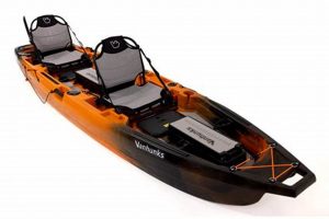
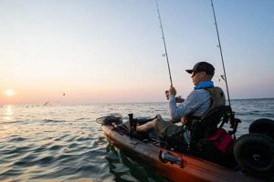
Software designed for mobile devices offers anglers a range of tools specifically tailored for kayak fishing. These tools often include features like GPS navigation with offline maps, fish finding sonar compatibility, tide and weather forecasting, logbooks for recording catches, and social features for sharing locations and experiences with other anglers.
Mobile device software enhances the safety and efficiency of kayak anglers. Real-time weather updates and navigation assistance are critical for navigating unfamiliar waters and changing conditions. Integration with fish finders and the ability to log catches provides valuable data for improving fishing techniques and understanding fish behavior. Historically, anglers relied on paper charts, personal experience, and limited weather reports. These applications represent a significant advancement in planning, executing, and analyzing fishing trips, allowing for a more informed and successful experience.
The following sections will delve deeper into specific features, explore leading applications available, and provide guidance on selecting the best software based on individual needs and preferences.
Tips for Utilizing Kayak Fishing Applications
Effective use of mobile applications can significantly enhance angling productivity and safety. The following tips offer guidance on maximizing the benefits of these tools.
Tip 1: Pre-Plan Routes and Mark Waypoints: Before launching, utilize the mapping features to plan routes, identify potential fishing spots based on depth charts and structure, and mark waypoints for navigation. This allows for efficient use of time on the water.
Tip 2: Download Offline Maps and Charts: Cellular service can be unreliable in many fishing locations. Downloading offline maps ensures continuous access to navigational information, regardless of connectivity.
Tip 3: Monitor Weather Forecasts Regularly: Weather conditions can change rapidly. Regularly checking the integrated weather forecasts within the application allows for proactive adjustments to plans and ensures angler safety.
Tip 4: Utilize Sonar Integration Effectively: If the chosen application integrates with sonar devices, learn to interpret the data displayed to identify fish-holding structures and locate target species.
Tip 5: Log Catches and Environmental Conditions: Consistently logging catches, including species, size, and location, along with environmental factors like water temperature and tide, provides valuable data for future trips.
Tip 6: Explore Social Features and Local Fishing Reports: Some applications offer social features allowing anglers to connect with each other, share information, and access local fishing reports. These features can provide valuable insights and enhance the overall experience.
Tip 7: Conserve Battery Power: Mobile device batteries can drain quickly, especially when using GPS and sonar features. Consider carrying a portable power bank or utilizing power-saving modes to ensure the device lasts throughout the fishing trip.
By following these tips, anglers can effectively leverage the power of mobile applications to improve their fishing success and ensure a safe and enjoyable experience on the water.
The concluding section will summarize the key benefits and encourage readers to explore the world of kayak fishing applications further.
Navigation plays a crucial role in kayak fishing, and dedicated applications offer significant advantages over traditional methods. These applications utilize GPS technology to provide real-time location tracking, allowing anglers to navigate unfamiliar waters, mark productive fishing spots, and return safely to their launch points. Unlike paper charts, digital maps within these applications can be updated dynamically, reflecting changes in navigational buoys, hazards, and other critical information. Consider a scenario where an angler discovers a submerged reef teeming with fish. Using a kayak fishing application, they can mark the location as a waypoint, ensuring they can easily return to the spot on future trips. This precise navigation capability is particularly beneficial in areas with complex shorelines, numerous islands, or limited visibility.
Beyond basic GPS functionality, many applications offer advanced navigational tools like route planning and offline map access. Anglers can pre-plan their fishing routes, incorporating waypoints for specific targets or areas of interest. This feature facilitates efficient time management on the water, allowing anglers to maximize fishing time and minimize travel. Furthermore, downloading offline maps ensures navigational capability even in areas with limited or no cellular coverage, a crucial safety feature for kayak anglers venturing into remote locations. For example, an angler planning a multi-day trip in a wilderness area can download detailed offline maps, ensuring navigational support regardless of cellular service availability. This preparedness enhances both safety and fishing effectiveness.
In summary, integrated navigation tools within kayak fishing applications significantly enhance the angler’s experience. From precise location tracking and waypoint marking to advanced route planning and offline map access, these features provide a level of navigational control and safety previously unavailable to kayak anglers. The ability to efficiently navigate to productive fishing areas, return safely to launch points, and explore new waters with confidence underscores the critical importance of navigation in kayak fishing and the significant advantages offered by dedicated applications.
2. Fish finding
Effective fish finding is crucial for successful angling, and kayak fishing applications offer integrated tools and functionalities that significantly enhance this aspect of the experience. These applications bridge the gap between traditional fish finding methods and modern technology, providing kayak anglers with valuable insights into underwater environments and fish behavior.
- Sonar Integration:
Many kayak fishing applications seamlessly integrate with sonar devices, transforming mobile devices into powerful fish finders. Sonar technology uses sound waves to create detailed images of the underwater terrain, revealing structures like reefs, drop-offs, and vegetation, which are often prime fish-holding locations. This real-time data allows anglers to identify promising fishing spots and adjust their strategies accordingly. For example, an angler might use sonar data to identify a submerged rock pile and then target the area with specific lures or bait known to attract fish in such environments.
- GPS Waypoint Marking:
Once a productive fishing area is identified via sonar or other methods, kayak fishing applications allow anglers to mark the location with a GPS waypoint. This feature ensures that anglers can easily return to these hotspots on future trips, even if the location isn’t visually apparent from the surface. Consider an angler who locates a school of fish along a deep channel edge. Marking the location with a GPS waypoint allows them to revisit the precise location during subsequent fishing trips, increasing the likelihood of success.
- Species-Specific Data and Insights:
Some advanced kayak fishing applications provide information on the habitat preferences and behavior of various fish species. This data can be invaluable for targeting specific species. For instance, if an angler is targeting largemouth bass, the application might suggest focusing on areas with submerged vegetation or rocky structures, the preferred habitats of this species. This targeted approach significantly enhances the angler’s efficiency and increases the chances of landing the desired catch.
- Offline Maps and Charts:
Many kayak fishing applications offer the ability to download offline maps and nautical charts. This feature is particularly important for fish finding in remote locations where cellular service may be unreliable. Offline access to bathymetric charts, which display water depth contours, allows anglers to identify underwater features like submerged humps or channels that often attract fish, even without a live internet connection. This empowers anglers to explore new areas and effectively locate fish in diverse environments.
By combining sonar integration, GPS waypoint marking, species-specific data, and offline map access, kayak fishing applications provide a comprehensive suite of tools that empower anglers to locate fish more effectively. This technological integration significantly improves the overall fishing experience, enhancing both efficiency and the likelihood of a successful outing.
3. Weather Forecasting
Weather forecasting is paramount for safe and successful kayak fishing. Integrated weather features within dedicated applications provide critical information directly to anglers on the water, facilitating informed decision-making and enhancing safety protocols. Access to accurate and timely weather data empowers anglers to adapt to changing conditions, maximizing fishing time while minimizing risks associated with adverse weather.
- Real-time Updates:
Kayak fishing applications provide real-time weather updates, delivering up-to-the-minute information on current conditions and short-term forecasts directly to the angler’s mobile device. This immediacy is crucial for responding to rapidly changing weather patterns, allowing anglers to make informed decisions about whether to continue fishing, seek shelter, or adjust their location. Consider an angler experiencing a sudden shift in wind direction and increasing cloud cover. Real-time updates within the application provide immediate notification of approaching storms, enabling a timely return to shore.
- Hyperlocal Forecasts:
Many applications offer hyperlocal weather forecasts, providing highly specific predictions for the angler’s precise location. This granularity is essential for kayak fishing, as conditions can vary significantly even within small distances. For instance, a localized thunderstorm might impact one section of a lake while leaving other areas unaffected. Hyperlocal forecasts allow anglers to identify these microclimates and make strategic decisions about where to fish based on the most favorable conditions.
- Marine-Specific Data:
Unlike general weather applications, kayak fishing applications often include marine-specific data, such as wind speed and direction, wave height, water temperature, and tide charts. This specialized information is critical for assessing fishing conditions and ensuring safe navigation on the water. For example, knowledge of wind speed and direction allows anglers to anticipate drift patterns and adjust their paddling strategy accordingly, while information on wave height helps assess the safety of venturing into open water.
- Severe Weather Alerts:
Safety is paramount in kayak fishing, and many applications incorporate severe weather alerts. These alerts notify anglers of approaching storms, high winds, lightning strikes, or other hazardous conditions, providing crucial time to seek shelter or return to shore. Consider an angler fishing several miles offshore. A timely severe weather alert for an approaching squall line allows them to take immediate action, ensuring their safety on the open water.
The integration of comprehensive weather forecasting within kayak fishing applications empowers anglers with the information necessary for both successful and safe fishing trips. Access to real-time updates, hyperlocal forecasts, marine-specific data, and severe weather alerts enhances decision-making, enabling anglers to adapt to changing conditions and prioritize safety on the water. This informed approach maximizes fishing opportunities while mitigating the risks associated with unpredictable weather patterns, underscoring the crucial role of weather forecasting in the modern kayak fishing experience.
4. Safety Features
Safety is a paramount concern in kayak fishing, and specialized applications contribute significantly to mitigating risks inherent in the activity. These applications offer integrated safety features designed to enhance angler preparedness, facilitate emergency communication, and provide real-time location awareness, fostering a more secure environment on the water.
Applications often integrate with a device’s GPS to provide precise location data, enabling real-time tracking and location sharing. This functionality allows designated contacts to monitor an angler’s position throughout a fishing trip, providing an added layer of security, particularly in remote or unfamiliar areas. In the event of an emergency, the ability to quickly and accurately relay one’s location to rescue services is critical. Furthermore, some applications include emergency SOS features, allowing anglers to send distress signals with their precise coordinates to predefined emergency contacts or rescue organizations. Consider a scenario where an angler capsizes in challenging conditions. The application’s location sharing and SOS features provide a crucial link to assistance, expediting response times and potentially mitigating serious consequences.
Beyond emergency communication, kayak fishing applications contribute to safety by providing access to real-time weather information and navigational aids. Up-to-date weather forecasts allow anglers to avoid hazardous conditions, while navigational tools help prevent disorientation and ensure safe passage, particularly in areas with complex shorelines or limited visibility. Integrating these features within a single application streamlines access to essential safety information, empowering anglers to make informed decisions and prioritize safe practices on the water. The capacity to anticipate and respond to changing conditions significantly reduces risks associated with kayak fishing, promoting a safer and more enjoyable experience for all.
5. Trip Logging
Trip logging functionality within kayak fishing applications provides a valuable tool for recording and analyzing fishing experiences. This digital record-keeping allows anglers to track various data points, contributing to improved understanding of fish behavior, location-specific patterns, and overall angling effectiveness over time. By meticulously documenting trips, anglers gain insights that can inform future strategies and enhance long-term success.
- Catch Documentation:
Applications allow for detailed logging of each catch, including species, size, weight, and time of capture. This data creates a comprehensive record of fishing success and provides valuable insights into fish populations and individual species behavior. For example, consistently logging catches in a specific location can reveal patterns related to species prevalence and optimal fishing times. This data-driven approach allows anglers to refine techniques and target specific species more effectively.
- Location Tracking:
Integrated GPS functionality automatically tracks the angler’s location throughout the fishing trip. This information, combined with catch data, allows anglers to identify productive fishing spots and correlate catches with specific locations, depths, or environmental factors. Over time, this data can reveal patterns, such as the preferred locations of certain species at different times of day or under varying tidal conditions. This location-based analysis enables anglers to optimize their fishing strategies based on historical data and location-specific insights.
- Environmental Data Recording:
Many applications allow anglers to record environmental conditions, such as water temperature, tide levels, weather patterns, and lunar phases. Correlating this environmental data with catch logs provides valuable insights into how these factors influence fish behavior and angling success. For instance, an angler might observe a correlation between water temperature and the activity levels of a particular species, enabling them to target that species during optimal temperature ranges. This data-driven understanding of environmental influences empowers anglers to make informed decisions and enhance their fishing effectiveness.
- Equipment and Bait Tracking:
Some applications allow anglers to log the specific equipment and bait used for each catch. This data can be invaluable for determining the most effective lures, rigs, or bait types for different species or under varying conditions. For example, an angler might discover that a specific lure type consistently produces better results for a target species during a particular season, enabling them to refine their tackle selection and maximize their chances of success. This systematic approach to equipment and bait tracking allows for continuous improvement and optimization of angling techniques.
By meticulously logging these various data points, kayak fishing applications empower anglers to analyze historical trends, identify productive patterns, and continuously refine their fishing strategies. This data-driven approach transforms the fishing experience from a recreational activity into a quantifiable and analyzable pursuit, maximizing efficiency and fostering a deeper understanding of the underwater environment and its inhabitants. The insights gleaned from trip logging contribute significantly to long-term improvement and enhanced angling success.
6. Offline Functionality
Offline functionality is a critical aspect of kayak fishing applications, ensuring usability and safety in locations where network connectivity is unreliable or nonexistent. Many prime fishing spots are situated in remote areas with limited cellular coverage, making offline access to crucial features essential for a successful and safe fishing trip. The ability to access maps, charts, and other essential data without relying on a live internet connection significantly enhances the utility and reliability of these applications in diverse environments.
- Map Access:
Offline map access is arguably the most crucial offline feature. Kayak anglers often venture into areas with limited or no cellular coverage, making offline maps essential for navigation. Downloading detailed maps of the fishing area before embarking ensures continuous access to navigational information, regardless of connectivity. This functionality allows anglers to explore new waters, navigate safely, and return to their launch points confidently, even in remote locations.
- GPS Functionality:
While GPS signals themselves do not require an internet connection, many of the features associated with GPS, such as location tracking and waypoint marking, rely on software functionalities that may require data access. Offline functionality ensures these features remain operational even without a network connection. This allows anglers to accurately track their position, mark productive fishing spots, and navigate effectively, regardless of cellular coverage. The ability to rely on GPS functionality offline significantly enhances safety and efficiency on the water.
- Weather Data:
Although real-time weather updates necessitate a network connection, some applications allow downloading of basic weather forecasts for offline access. While not as dynamic as live updates, this cached information can provide a general overview of expected conditions, allowing anglers to make informed decisions before and during their trip, even in the absence of real-time data. This can be particularly valuable when venturing into areas with unpredictable weather patterns.
- Downloaded Charts and Points of Interest:
Bathymetric charts, which display water depth contours, and points of interest, such as boat ramps or known fishing spots, can be downloaded for offline use. This provides anglers with valuable information about the underwater terrain and potential fishing locations, regardless of connectivity. Access to this data offline empowers anglers to explore new waters, locate promising fishing areas, and navigate safely, even in unfamiliar or remote environments.
Offline functionality enhances the reliability and utility of kayak fishing applications, transforming them into essential tools for anglers venturing into areas with limited or no cellular coverage. The ability to access critical features, such as navigation tools, GPS tracking, and downloaded charts, without relying on a live internet connection ensures safety, enhances efficiency, and expands the possibilities for exploration and fishing success in remote and challenging environments. This preparedness empowers anglers to confidently explore new waters and focus on the fishing experience, knowing they have access to the necessary tools and information regardless of connectivity limitations.
Frequently Asked Questions
This section addresses common inquiries regarding mobile applications designed for kayak fishing.
Question 1: Do these applications require specialized hardware for full functionality?
While core features like mapping and weather forecasting typically require only a standard mobile device, advanced functionalities such as sonar integration may necessitate compatible sonar hardware and transducers. Specific application requirements should be reviewed for hardware compatibility information.
Question 2: How accurate are the weather forecasts provided within these applications?
Weather forecasts are sourced from reputable meteorological services. However, inherent uncertainties exist in weather prediction. Users should treat forecasts as guidance and remain aware of changing conditions on the water. Consulting multiple weather sources is advisable.
Question 3: What are the typical battery consumption rates for these applications?
Battery consumption varies significantly based on factors such as screen brightness, GPS usage, sonar integration, and background activity. Utilizing power-saving modes and carrying a portable power bank is recommended for extended trips.
Question 4: Are these applications suitable for use in saltwater environments?
Many applications offer features tailored for both freshwater and saltwater fishing, including tide charts, sea surface temperatures, and navigational information relevant to marine environments. Application descriptions should specify suitability for saltwater use.
Question 5: How frequently are maps and charts updated within these applications?
Map and chart update frequencies vary depending on the application provider and the specific data source. Regular updates are essential for maintaining accuracy. Users should consult application documentation or support resources for update frequency information.
Question 6: Can these applications replace traditional navigational tools and safety equipment?
While these applications enhance safety and navigation, they should not replace essential safety gear such as personal flotation devices, communication devices, and basic navigational knowledge. Applications are tools to be used in conjunction with, not as replacements for, standard safety practices and equipment.
Careful consideration of these frequently asked questions will assist anglers in selecting and effectively utilizing kayak fishing applications.
The subsequent section will offer concluding remarks on the utility and future of kayak fishing applications.
Conclusion
Kayak fishing applications represent a significant advancement in angling technology, offering a comprehensive suite of tools that enhance safety, efficiency, and overall fishing success. From navigation and fish finding to weather forecasting and trip logging, these applications empower anglers with unprecedented access to information and resources. The integration of GPS technology, sonar compatibility, and real-time weather data transforms mobile devices into indispensable tools for the modern kayak angler. Offline functionality extends the reach of these applications into remote areas, ensuring access to critical features regardless of cellular connectivity. The ability to meticulously log catches, track environmental conditions, and analyze historical trends fosters a data-driven approach to fishing, enabling continuous improvement and a deeper understanding of the underwater environment.
As technology continues to evolve, kayak fishing applications will undoubtedly play an increasingly important role in the sport. Further integration with emerging technologies, such as augmented reality and advanced sonar systems, promises to unlock even greater potential for enhancing the fishing experience. Anglers who embrace these technological advancements will be well-equipped to maximize their time on the water, improve their understanding of fish behavior, and ultimately, enhance their fishing success while prioritizing safety and responsible angling practices.


